Randonnée V.T.T. Cleebourg - Petite sortie VTT sympa secteur Wissembourg - Photo

Petite sortie VTT sympa secteur Wissembourg

 tracegps
tracegps

Utilisateur

© OpenStreetMap contributors
Longueur
Longueur
23 km
Altitude max
Altitude max
486 m
Dénivelé positif
Dénivelé positif
639 m
Km-Effort
Km-Effort  
32 km
Altitude min
Altitude min
168 m
Dénivelé négatif
Dénivelé négatif
641 m
Boucle
Boucle
Oui
Date de création :
2014-12-10 00:00:00.0
Dernière modification :
2014-12-10 00:00:00.0

(1 Avis)

V.T.T.
V.T.T.
2h30
Difficulté : Moyen

Scannez ce code QR pour ouvrir la randonnée dans l'application SityTrail

Application GPS de randonnée GRATUITE

Logo SityTrail SityTrail

IGN / Instituts géographiques

Télécharger SityTrail sur l'App Store Télécharger SityTrail sur Google Play

Logo SityTrail SityTrail World

Le monde est à vous

Télécharger SityTrail sur l'App Store Télécharger SityTrail sur Google Play Télécharger SityTrail sur Huawei AppGallery

À propos

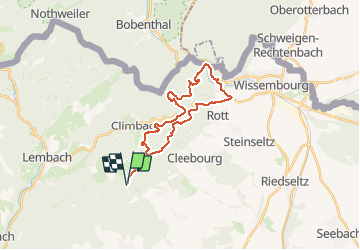
Randonnée V.T.T. de 23 km à découvrir à Grand Est, Bas-Rhin, Cleebourg. Cette randonnée est proposée par tracegps.

Description

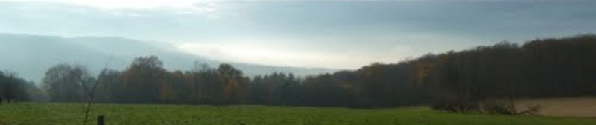
Petite sortie offrant de beaux panoramas, un joli petit dénivelé, aucune difficulté notoire hormis le fossé antichar à traverser (attention une quinzaine de marche sans rambardes où il faudra porter le vélo). Le parcours n'emprunte que des sentiers du club vosgien qui sont bien dégagés.

Profil altimétrique

Photos

Localisation

Pays :
France
Région :
Grand Est
Département/Province :
Bas-Rhin
Commune :
Cleebourg
Localité :
Unknown
Départ:(Dec)
Départ:(UTM)
415547 ; 5427161 (32U) N.

Commentaires

Veuillez vous connecter pour laisser un commentaire ou une note


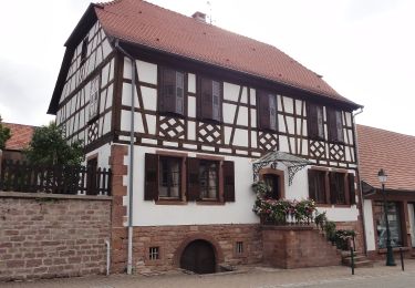
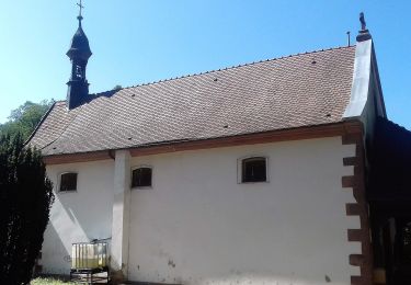
Parcours très sympa !


Randonnées à proximité

Randonnée Randonnée équestre Wingen - Boucle Loewenstein Hohenbourg Fleckenstein - Photo
Randonnée équestre
GUIDE+

Randonnée équestre

Moyen
(1)
Wingen, Grand Est, Bas-Rhin, France
18,4 km | 26 km-effort
3h 8min
Oui
Randonnée A pied Lembach - Anneau vert - Photo
A pied
PRO

A pied

Facile
Lembach, Grand Est, Bas-Rhin, France
3,8 km | 5,2 km-effort
1h 10min
Oui
Randonnée A pied Climbach - Triangle vert - Photo
A pied
PRO

A pied

Facile
Climbach, Grand Est, Bas-Rhin, France
10,3 km | 15 km-effort
3h 24min
Non
Randonnée A pied Cleebourg - Disque jaune - Photo
A pied
PRO

A pied

Moyen
Cleebourg, Grand Est, Bas-Rhin, France
20 km | 27 km-effort
6h 13min
Non
Randonnée A pied Soultz-sous-Forêts - Triangle bleu - Photo
A pied
PRO

A pied

Facile
Soultz-sous-Forêts, Grand Est, Bas-Rhin, France
6,1 km | 7,2 km-effort
1h 38min
Non
Randonnée A pied Lembach - Rectangle bleu barré de blanc - Photo
A pied
PRO

A pied

Facile
Lembach, Grand Est, Bas-Rhin, France
4 km | 6 km-effort
1h 21min
Non
Randonnée A pied Wingen - Croix rouge - Photo
A pied
PRO

A pied

Facile
Wingen, Grand Est, Bas-Rhin, France
5,4 km | 7,4 km-effort
1h 41min
Non
Randonnée A pied Lembach - Croix bleue - Photo
A pied
PRO

A pied

Facile
Lembach, Grand Est, Bas-Rhin, France
12,8 km | 18,4 km-effort
4h 10min
Non
Randonnée A pied Wingen - Anneau rouge - Photo
A pied
PRO

A pied

Facile
Wingen, Grand Est, Bas-Rhin, France
6,4 km | 9 km-effort
2h 2min
Oui


Fermer
Mes abonnements