Randonnée Marche Castelnaud-la-Chapelle - Balade autour de Castelnaud la Chapelle - Photo

Balade autour de Castelnaud la Chapelle

 tracegps
tracegps

Utilisateur

© OpenStreetMap contributors
Longueur
Longueur
13,5 km
Altitude max
Altitude max
239 m
Dénivelé positif
Dénivelé positif
415 m
Km-Effort
Km-Effort  
19 km
Altitude min
Altitude min
74 m
Dénivelé négatif
Dénivelé négatif
414 m
Boucle
Boucle
Oui
Date de création :
2014-12-10 00:00:00.0
Dernière modification :
2014-12-10 00:00:00.0

(0 Avis)

Marche
Marche
3h30
Difficulté : Moyen

Scannez ce code QR pour ouvrir la randonnée dans l'application SityTrail

Application GPS de randonnée GRATUITE

Logo SityTrail SityTrail

IGN / Instituts géographiques

Télécharger SityTrail sur l'App Store Télécharger SityTrail sur Google Play

Logo SityTrail SityTrail World

Le monde est à vous

Télécharger SityTrail sur l'App Store Télécharger SityTrail sur Google Play Télécharger SityTrail sur Huawei AppGallery

À propos

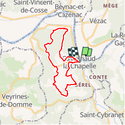
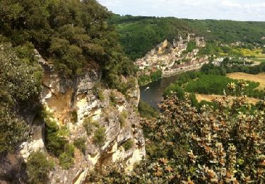
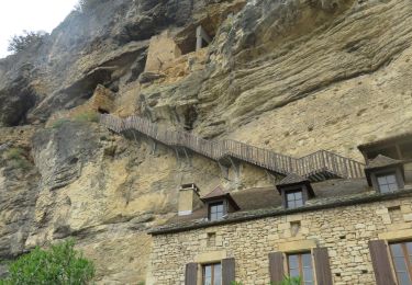
Randonnée Marche de 13,5 km à découvrir à Nouvelle-Aquitaine, Dordogne, Castelnaud-la-Chapelle. Cette randonnée est proposée par tracegps.

Description

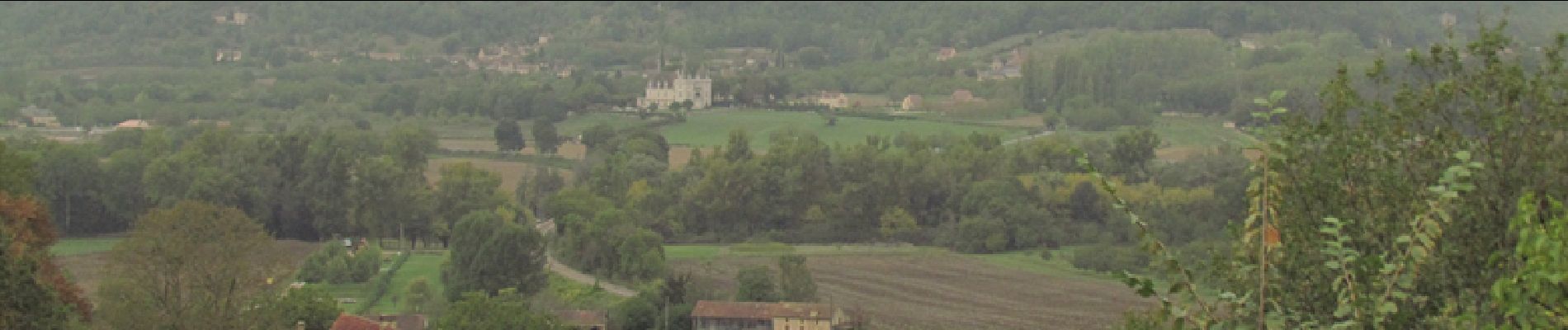
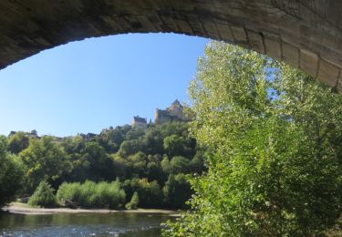
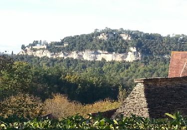
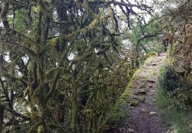
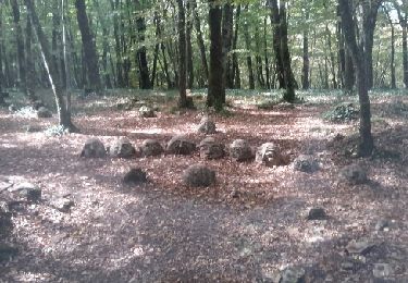
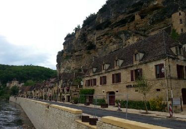
Une randonnée très sympathique empruntant d'agréables sentiers en sous bois. On découvre ainsi les environs de Castelnaud en traversant plusieurs hameaux. En fin de parcours on profite de très belles vues sur Beynac et son château. Balade à faire en automne pour faire provision de noix, châtaignes et figues.

Profil altimétrique

Photos

Points d'intérêt

Point d'intérêt Castelnaud-la-Chapelle - CHATEAU - Photo
tracegps
CASTELNAUD-LA-CHAPELLE 
Point d'intérêt Castelnaud-la-Chapelle - DEPART CASTEL - Photo
tracegps
CASTELNAUD-LA-CHAPELLE 
Point d'intérêt Castelnaud-la-Chapelle - PT VUE - Photo
tracegps
CASTELNAUD-LA-CHAPELLE 

Localisation

Pays :
France
Région :
Nouvelle-Aquitaine
Département/Province :
Dordogne
Commune :
Castelnaud-la-Chapelle
Localité :
Unknown
Départ:(Dec)
Départ:(UTM)
353824 ; 4963907 (31T) N.

Randonnées à proximité

Randonnée Marche La Roque-Gageac - La Roque-Gageac - Cazenac - Photo
Marche
houbart

Marche

Difficile
(1)
La Roque-Gageac, Nouvelle-Aquitaine, Dordogne, France
12,9 km | 17,3 km-effort
3h 55min
Oui
Randonnée Marche Castelnaud-la-Chapelle - Castelnaud 14,5km - Photo
Marche
amelie14

Marche

Moyen
(1)
Castelnaud-la-Chapelle, Nouvelle-Aquitaine, Dordogne, France
14,3 km | 18,3 km-effort
3h 41min
Oui
Randonnée Marche La Roque-Gageac - Vitrac Domme  - Photo
Marche
reneperrin

Marche

Facile
(1)
La Roque-Gageac, Nouvelle-Aquitaine, Dordogne, France
14,6 km | 19,1 km-effort
4h 4min
Oui
Randonnée Marche La Roque-Gageac - boucle La Roque Gageac - Beynac - Photo
Marche
jcc24

Marche

Difficile
La Roque-Gageac, Nouvelle-Aquitaine, Dordogne, France
18,1 km | 27 km-effort
5h 7min
Oui
Randonnée Marche La Roque-Gageac - plus grand tour Roque Gageac - Photo
Marche
dedeyned

Marche

Très difficile
(1)
La Roque-Gageac, Nouvelle-Aquitaine, Dordogne, France
16,5 km | 25 km-effort
5h 11min
Oui
Randonnée Moteur Vézac - Jardin du château de Marquesac - Photo
Moteur
ohubau

Moteur

Très difficile
Vézac, Nouvelle-Aquitaine, Dordogne, France
5,3 km | 6,8 km-effort
4h 19min
Oui
Randonnée Marche La Roque-Gageac - La Roque Gageac - Photo
Marche
Ajax44

Marche

Moyen
La Roque-Gageac, Nouvelle-Aquitaine, Dordogne, France
9,7 km | 14,6 km-effort
3h 15min
Non
Randonnée Marche Vézac - 2011-06-03 - 17h56m53 - Photo
Marche
infamerr

Marche

Très facile
(1)
Vézac, Nouvelle-Aquitaine, Dordogne, France
1,2 km | 1,8 km-effort
Inconnu
Oui
Randonnée Marche La Roque-Gageac - LA ROQUE GAGEAC BEYNAC MARQUESSAC - Photo
Marche
houbart

Marche

Difficile
La Roque-Gageac, Nouvelle-Aquitaine, Dordogne, France
12,4 km | 17 km-effort
3h 51min
Oui


Fermer
Mes abonnements