Randonnée V.T.T. Plouzané - boucle karembar - Photo
© OpenStreetMap contributors
Longueur
Longueur
35 km
Altitude max
Altitude max
93 m
Dénivelé positif
Dénivelé positif
450 m
Km-Effort
Km-Effort  
41 km
Altitude min
Altitude min
4 m
Dénivelé négatif
Dénivelé négatif
453 m
Boucle
Boucle
Oui
Date de création :
2014-12-10 00:00:00.0
Dernière modification :
2014-12-10 00:00:00.0

(1 Avis)

V.T.T.
V.T.T.
2h40
Difficulté : Facile

Scannez ce code QR pour ouvrir la randonnée dans l'application SityTrail

Application GPS de randonnée GRATUITE

Logo SityTrail SityTrail

IGN / Instituts géographiques

Télécharger SityTrail sur l'App Store Télécharger SityTrail sur Google Play

Logo SityTrail SityTrail World

Le monde est à vous

Télécharger SityTrail sur l'App Store Télécharger SityTrail sur Google Play Télécharger SityTrail sur Huawei AppGallery

À propos

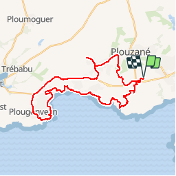
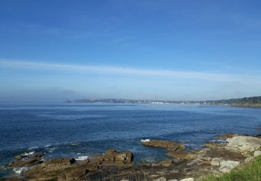
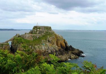
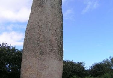
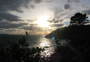
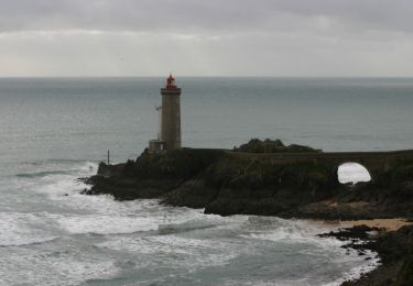
Randonnée V.T.T. de 35 km à découvrir à Bretagne, Finistère, Plouzané. Cette randonnée est proposée par Thierrybouteiller17.

Profil altimétrique

Localisation

Pays :
France
Région :
Bretagne
Département/Province :
Finistère
Commune :
Plouzané
Localité :
Unknown
Départ:(Dec)
Départ:(UTM)
380872 ; 5358051 (30U) N.

Commentaires

Veuillez vous connecter pour laisser un commentaire ou une note


kan yen a marre ya kerlambar


Randonnées à proximité

Randonnée V.T.T. Plouzané - Tournerre de Brest - Photo
V.T.T.
tracegps

V.T.T.

Difficile
(1)
Plouzané, Bretagne, Finistère, France
50 km | 58 km-effort
4h 0min
Oui
Randonnée Marche Locmaria-Plouzané - 11.09.23  Pen Ar Menez  --  Brest - Photo
Marche
donda

Marche

Très difficile
Locmaria-Plouzané, Bretagne, Finistère, France
22 km | 28 km-effort
6h 25min
Non
Randonnée Marche Plouzané - Tour Toulbroc'h et Deolen - Photo
Marche

Marche

Facile
Plouzané, Bretagne, Finistère, France
8 km | 10 km-effort
2h 12min
Oui
Randonnée Marche Locmaria-Plouzané - Les falaises de Doélen - Photo
Marche
Patricia Castagné

Marche

Moyen
Locmaria-Plouzané, Bretagne, Finistère, France
12 km | 14,7 km-effort
2h 45min
Non
Randonnée Marche Plouzané - Saint-sané - Photo
Marche
jmboucher

Marche

Facile
Plouzané, Bretagne, Finistère, France
12,1 km | 13,6 km-effort
2h 18min
Oui
Randonnée Marche Plouzané - GR 34® de la Pointe du Petit-Minou à Brest   - Photo
Marche
tracegps

Marche

Moyen
Plouzané, Bretagne, Finistère, France
14,2 km | 18,2 km-effort
3h 19min
Non
Randonnée Marche Plouzané - De Plouzané au Bois de Kervéatouz par le Menhir de Kerloas - Photo
Marche
tracegps

Marche

Difficile
Plouzané, Bretagne, Finistère, France
31 km | 37 km-effort
6h 0min
Oui
Randonnée Marche Plouzané - De Plouzané au Fort du Dellec - Photo
Marche
tracegps

Marche

Moyen
Plouzané, Bretagne, Finistère, France
16,4 km | 20 km-effort
3h 30min
Oui
Randonnée Marche Plouzané - De la Pointe du Petit Minou à la plage de Tregana - Photo
Marche
tracegps

Marche

Moyen
(1)
Plouzané, Bretagne, Finistère, France
17 km | 21 km-effort
4h 0min
Oui


Fermer
Mes abonnements