Randonnée Marche Saint-Christophe-sur-Guiers - 2013 05 05 Rocher du Frou - Photo
 lechner
lechner

Utilisateur

© OpenStreetMap contributors
Longueur
Longueur
9,7 km
Altitude max
Altitude max
1163 m
Dénivelé positif
Dénivelé positif
743 m
Km-Effort
Km-Effort  
19,6 km
Altitude min
Altitude min
572 m
Dénivelé négatif
Dénivelé négatif
737 m
Boucle
Boucle
Oui
Date de création :
2018-08-07 09:25:31.494
Dernière modification :
2018-08-07 09:25:31.592

(0 Avis)

Marche
Marche
3h57
Difficulté : Très facile

Scannez ce code QR pour ouvrir la randonnée dans l'application SityTrail

Application GPS de randonnée GRATUITE

Logo SityTrail SityTrail

IGN / Instituts géographiques

Télécharger SityTrail sur l'App Store Télécharger SityTrail sur Google Play

Logo SityTrail SityTrail World

Le monde est à vous

Télécharger SityTrail sur l'App Store Télécharger SityTrail sur Google Play Télécharger SityTrail sur Huawei AppGallery

À propos

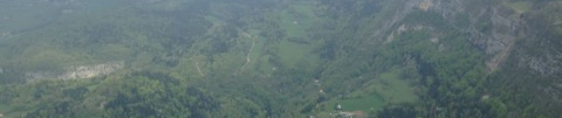
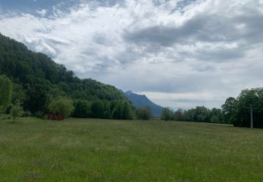
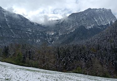
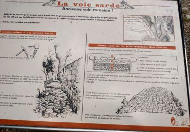
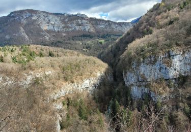
Randonnée Marche de 9,7 km à découvrir à Auvergne-Rhône-Alpes, Isère, Saint-Christophe-sur-Guiers. Cette randonnée est proposée par lechner.

Profil altimétrique

Photos

Localisation

Pays :
France
Région :
Auvergne-Rhône-Alpes
Département/Province :
Isère
Commune :
Saint-Christophe-sur-Guiers
Localité :
Unknown
Départ:(Dec)
Départ:(UTM)
718893 ; 5034750 (31T) N.

Randonnées à proximité

Randonnée Raquettes à neige Saint-Christophe-sur-Guiers - Le Belvédère d'Arpison - Photo
Raquettes à neige
patjobou

Raquettes à neige

Moyen
(1)
Saint-Christophe-sur-Guiers, Auvergne-Rhône-Alpes, Isère, France
11,1 km | 17,4 km-effort
4h 43min
Oui
Randonnée Marche Saint-Pierre-d'Entremont - Roche Veyrand par les Clapiers, 1429m - Photo
Marche
tracegps

Marche

Difficile
(1)
Saint-Pierre-d'Entremont, Auvergne-Rhône-Alpes, Savoie, France
4,8 km | 14,3 km-effort
4h 10min
Oui
Randonnée Marche Entremont-le-Vieux - Traversée du Mont Outheran 1676m - Photo
Marche
tracegps

Marche

Difficile
(1)
Entremont-le-Vieux, Auvergne-Rhône-Alpes, Savoie, France
9 km | 15,9 km-effort
3h 30min
Oui
Randonnée Marche Saint-Christophe-sur-Guiers - Petit Som 1772m,  depuis La Ruchère - Photo
Marche
tracegps

Marche

Moyen
(2)
Saint-Christophe-sur-Guiers, Auvergne-Rhône-Alpes, Isère, France
6 km | 13,2 km-effort
3h 30min
Oui
Randonnée Marche Saint-Christophe-sur-Guiers - Petit Som par le Col de la Ruchère - Photo
Marche
simon.paume

Marche

Moyen
(2)
Saint-Christophe-sur-Guiers, Auvergne-Rhône-Alpes, Isère, France
7,1 km | 15,2 km-effort
3h 5min
Oui
Randonnée sport Saint-Christophe - La grotte - Photo
sport
Biquette73

sport

Très facile
Saint-Christophe, Auvergne-Rhône-Alpes, Savoie, France
8,9 km | 14,1 km-effort
Inconnu
Non
Randonnée Marche Saint-Pierre-d'Entremont - Cirque de Saint Même depuis Saint Pierre d'Entremont - Photo
Marche
chuck

Marche

Moyen
Saint-Pierre-d'Entremont, Auvergne-Rhône-Alpes, Isère, France
10,9 km | 17,2 km-effort
4h 22min
Oui
Randonnée Marche Saint-Christophe - la voie SARDE / tunnel des l'Echelles /st Christophe sur Guiers - Photo
Marche
okfred26

Marche

Très difficile
Saint-Christophe, Auvergne-Rhône-Alpes, Savoie, France
15,1 km | 23 km-effort
5h 12min
Oui
Randonnée Marche Saint-Christophe - 190323 Boucle voie Sarde - Photo
Marche
mzonzon05

Marche

Difficile
Saint-Christophe, Auvergne-Rhône-Alpes, Savoie, France
9,7 km | 15,6 km-effort
3h 50min
Oui


Fermer
Mes abonnements