Randonnée V.T.T. Saint-Chamas - st chamas 06.05.2013 - Photo
 gloeren
gloeren

Utilisateur

© OpenStreetMap contributors
Longueur
Longueur
19,4 km
Altitude max
Altitude max
113 m
Dénivelé positif
Dénivelé positif
345 m
Km-Effort
Km-Effort  
24 km
Altitude min
Altitude min
0 m
Dénivelé négatif
Dénivelé négatif
283 m
Boucle
Boucle
Non
Date de création :
2014-12-10 00:00:00.0
Dernière modification :
2014-12-10 00:00:00.0

(0 Avis)

V.T.T.
V.T.T.
1h34
Difficulté : Facile

Scannez ce code QR pour ouvrir la randonnée dans l'application SityTrail

Application GPS de randonnée GRATUITE

Logo SityTrail SityTrail

IGN / Instituts géographiques

Télécharger SityTrail sur l'App Store Télécharger SityTrail sur Google Play

Logo SityTrail SityTrail World

Le monde est à vous

Télécharger SityTrail sur l'App Store Télécharger SityTrail sur Google Play Télécharger SityTrail sur Huawei AppGallery

À propos

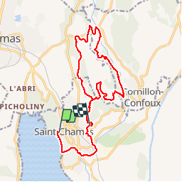
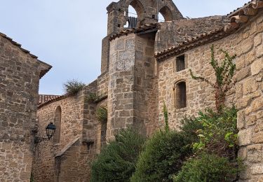
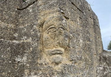
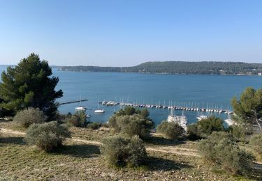
Randonnée V.T.T. de 19,4 km à découvrir à Provence-Alpes-Côte d'Azur, Bouches-du-Rhône, Saint-Chamas. Cette randonnée est proposée par gloeren.

Description

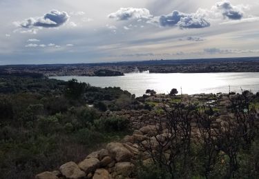
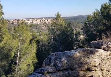
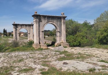
départ de st Chamas, passage par le pont Flavien,direction vers la Moria, remonter la Touloubre vers le nord, passage près du pont de Rhaud, puis vers le Mas de Guerin, puis retour St Chamas par la route.

Profil altimétrique

Localisation

Pays :
France
Région :
Provence-Alpes-Côte d'Azur
Département/Province :
Bouches-du-Rhône
Commune :
Saint-Chamas
Localité :
Unknown
Départ:(Dec)
Départ:(UTM)
664145 ; 4823879 (31T) N.

Randonnées à proximité

Randonnée Marche Miramas - Miramas le vieux- tour de guet - Photo
Marche
Berpav

Marche

Difficile
(1)
Miramas, Provence-Alpes-Côte d'Azur, Bouches-du-Rhône, France
14,4 km | 18 km-effort
3h 52min
Oui
Randonnée Marche Istres - Entre ville et nature - Istres - Photo
Marche
tracegps

Marche

Difficile
(2)
Istres, Provence-Alpes-Côte d'Azur, Bouches-du-Rhône, France
12,3 km | 14,7 km-effort
4h 0min
Oui
Randonnée Marche Miramas - Belval-Pont de Rhaud - Photo
Marche
Berpav

Marche

Facile
(1)
Miramas, Provence-Alpes-Côte d'Azur, Bouches-du-Rhône, France
9,5 km | 10,8 km-effort
2h 29min
Oui
Randonnée V.T.T. Istres - Challenge des entreprises Rotary Club - Photo
V.T.T.
Lecaps

V.T.T.

Facile
(1)
Istres, Provence-Alpes-Côte d'Azur, Bouches-du-Rhône, France
5,1 km | 5,6 km-effort
22min
Oui
Randonnée Marche Istres - Miramas Istres GR 2013 ALLER - Photo
Marche
hervef13300

Marche

Facile
(2)
Istres, Provence-Alpes-Côte d'Azur, Bouches-du-Rhône, France
7,6 km | 10 km-effort
2h 6min
Non
Randonnée Marche Saint-Chamas - St Chamas la Touloubre - Photo
Marche
nana1643

Marche

Facile
Saint-Chamas, Provence-Alpes-Côte d'Azur, Bouches-du-Rhône, France
9,3 km | 11,5 km-effort
4h 10min
Oui
Randonnée Marche Miramas - Miramas le Vieux St Chamas  - Photo
Marche
GUIDE
nadinebondoux

Marche

Moyen
Miramas, Provence-Alpes-Côte d'Azur, Bouches-du-Rhône, France
18,9 km | 24 km-effort
5h 56min
Oui
Randonnée Marche Miramas - Vieux Miramas  - Photo
Marche
GUIDE
Roger Philippe Wallez

Marche

Très difficile
Miramas, Provence-Alpes-Côte d'Azur, Bouches-du-Rhône, France
18,5 km | 24 km-effort
6h 40min
Oui
Randonnée Marche Saint-Chamas - St chamas - Photo
Marche
gaggiroland

Marche

Très facile
Saint-Chamas, Provence-Alpes-Côte d'Azur, Bouches-du-Rhône, France
12 km | 14,3 km-effort
3h 23min
Non


Fermer
Mes abonnements