Randonnée V.T.C. Froidchapelle - BEAUMONT-Tour des lacs de l'eau d'heure - Photo

BEAUMONT-Tour des lacs de l'eau d'heure

 jeanphi.hennebert
jeanphi.hennebert

Utilisateur

© OpenStreetMap contributors
Longueur
Longueur
36 km
Altitude max
Altitude max
283 m
Dénivelé positif
Dénivelé positif
411 m
Km-Effort
Km-Effort  
41 km
Altitude min
Altitude min
199 m
Dénivelé négatif
Dénivelé négatif
411 m
Boucle
Boucle
Oui
Date de création :
2018-08-06 15:44:32.214
Dernière modification :
2019-03-27 14:34:06.27

(0 Avis)

V.T.C.
V.T.C.
3h30
Difficulté : Facile

Scannez ce code QR pour ouvrir la randonnée dans l'application SityTrail

Application GPS de randonnée GRATUITE

Logo SityTrail SityTrail

IGN / Instituts géographiques

Télécharger SityTrail sur l'App Store Télécharger SityTrail sur Google Play

Logo SityTrail SityTrail World

Le monde est à vous

Télécharger SityTrail sur l'App Store Télécharger SityTrail sur Google Play Télécharger SityTrail sur Huawei AppGallery

À propos

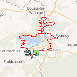
Randonnée V.T.C. de 36 km à découvrir à Wallonie, Hainaut, Froidchapelle. Cette randonnée est proposée par jeanphi.hennebert.

Description

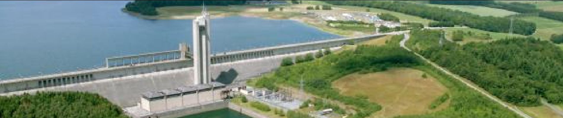
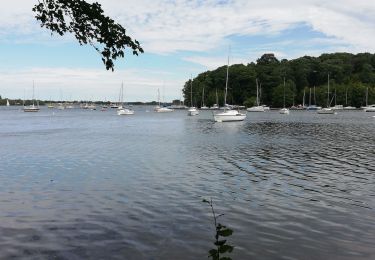
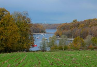
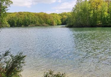
Environ un tiers en bois et campagnes, le reste longe l'eau.
Se garer à l'aérodrome et partir de là.

Profil altimétrique

Photos

Points d'intérêt

Point d'intérêt Froidchapelle - 31 - Photo
jeanphi.hennebert
FROIDCHAPELLE 
Point d'intérêt Froidchapelle - 97 - Photo
jeanphi.hennebert
FROIDCHAPELLE 
Point d'intérêt Froidchapelle - 96 - Photo
jeanphi.hennebert
FROIDCHAPELLE 
Point d'intérêt Froidchapelle - 90 - Photo
jeanphi.hennebert
FROIDCHAPELLE 
Point d'intérêt Froidchapelle - 91 - Photo
jeanphi.hennebert
FROIDCHAPELLE 
Point d'intérêt Froidchapelle - 87 - Photo
jeanphi.hennebert
FROIDCHAPELLE 
Point d'intérêt Froidchapelle - 86 - Photo
jeanphi.hennebert
FROIDCHAPELLE 
Point d'intérêt Cerfontaine - 88 - Photo
jeanphi.hennebert
CERFONTAINE 
Point d'intérêt Cerfontaine - 92 - Photo
jeanphi.hennebert
CERFONTAINE 
Point d'intérêt Cerfontaine - 93 - Photo
jeanphi.hennebert
CERFONTAINE 
Point d'intérêt Cerfontaine - 98 - Photo
jeanphi.hennebert
CERFONTAINE 
Point d'intérêt Cerfontaine - 29 - Photo
jeanphi.hennebert
CERFONTAINE 

Localisation

Pays :
Belgique
Région :
Wallonie
Département/Province :
Hainaut
Commune :
Froidchapelle
Localité :
Froid-Chapelle
Départ:(Dec)
Départ:(UTM)
597648 ; 5556680 (31U) N.

Randonnées à proximité

Randonnée V.T.T. Froidchapelle - Froidchapelle (7) - Promenade VTT - Photo
V.T.T.
GUIDE+

V.T.T.

Moyen
(4)
Froidchapelle, Wallonie, Hainaut, Belgique
32 km | 37 km-effort
2h 26min
Oui
Randonnée Marche Cerfontaine - cerfontaine  - Photo
Marche
kilou07

Marche

Très facile
(1)
Cerfontaine, Wallonie, Namur, Belgique
6,5 km | 7,9 km-effort
1h 42min
Oui
Randonnée Marche Cerfontaine - Balade au village de la source de l'eau d'Heure Cerfontaine - Photo
Marche
GUIDE
Desrumaux

Marche

Facile
(2)
Cerfontaine, Wallonie, Namur, Belgique
11,6 km | 14,7 km-effort
3h 11min
Oui
Randonnée Marche Froidchapelle - Le Tour du lac de la Plate Taille - Photo
Marche
GUIDE
Desrumaux

Marche

Facile
(3)
Froidchapelle, Wallonie, Hainaut, Belgique
15,8 km | 18 km-effort
4h 0min
Oui
Randonnée Marche Froidchapelle - Froidchapelle - Entre Champs et Forets - Photo
Marche
GUIDE
Desrumaux

Marche

Facile
(1)
Froidchapelle, Wallonie, Hainaut, Belgique
14,3 km | 17,1 km-effort
3h 20min
Oui
Randonnée Marche Froidchapelle - Du lac de l'Eau d'Heure vers la  Plate Taille - Photo
Marche
GUIDE
Desrumaux

Marche

Facile
(4)
Froidchapelle, Wallonie, Hainaut, Belgique
13,7 km | 16,2 km-effort
3h 20min
Oui
Randonnée A pied Froidchapelle - Balade au Lac de l'Eau d'Heure - Photo
A pied
GUIDE
Desrumaux

A pied

Facile
Froidchapelle, Wallonie, Hainaut, Belgique
8,9 km | 10,8 km-effort
2h 12min
Oui
Randonnée Marche Froidchapelle - La balade du bois du Grand Oupia aux lacs de l'eau d'heure - Photo
Marche
GUIDE+

Marche

Moyen
(4)
Froidchapelle, Wallonie, Hainaut, Belgique
8,7 km | 9,9 km-effort
2h 15min
Oui
Randonnée Marche Froidchapelle - Balade au Lac de la Plate Taille - Photo
Marche
GUIDE
Desrumaux

Marche

Moyen
Froidchapelle, Wallonie, Hainaut, Belgique
8,4 km | 9,8 km-effort
2h 57min
Oui


Fermer
Mes abonnements