


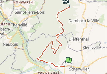

13 km | 18,5 km-effort


Utilisateur


Application GPS de randonnée GRATUITE
 SityTrail
IGN / Instituts géographiques
SityTrail World
Le monde est à vous
Randonnée V.T.T. de 12,4 km à découvrir à Grand Est, Bas-Rhin, Châtenois. Cette randonnée est proposée par nave.
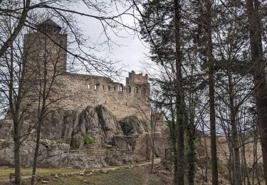
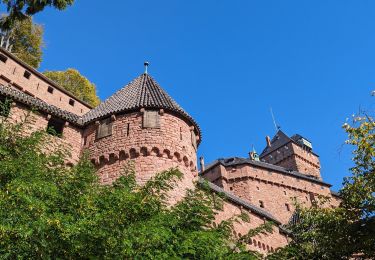
Châteaux Ortenbourg Ramstein Bernstein

Marche

Marche

Marche

Marche

V.T.T.
Marche
Marche

Marche
Marche