


Leimbach - Chalet Zuber

patrickbeyrath
Utilisateur
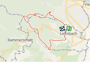

Longueur
8,5 km

Altitude max
647 m

Dénivelé positif
341 m
Km-Effort
13 km

Altitude min
357 m

Dénivelé négatif
337 m
Boucle
Oui
Date de création :
2018-12-07 08:21:02.977
Dernière modification :
2018-12-07 08:27:56.896
2h42
Difficulté : Moyen

Application GPS de randonnée GRATUITE
 SityTrail
IGN / Instituts géographiques
SityTrail Plus
Le monde est à vous
À propos
Randonnée Marche de 8,5 km à découvrir à Grand Est, Haut-Rhin, Leimbach. Cette randonnée est proposée par patrickbeyrath.
Description
Parking mairie Leimbach - Les Trois Chênes ) Tempel - Muhlberg - Col du Teufelsgrund - Chalet Zuber - descente rond rouge puis prendre à gauche Riegelsbourg et retour parking
Localisation
Pays :
France
Région :
Grand Est
Département/Province :
Haut-Rhin
Commune :
Leimbach
Localité :
Unknown
Départ:(Dec)
Départ:(UTM)
357786 ; 5295059 (32T) N.
Commentaires