Randonnée A pied Bozouls - BARRIAC / CARCUAC - Photo

BARRIAC / CARCUAC

 Strabidja
Strabidja

Utilisateur

© OpenStreetMap contributors
Longueur
Longueur
3,9 km
Altitude max
Altitude max
575 m
Dénivelé positif
Dénivelé positif
69 m
Km-Effort
Km-Effort  
4,8 km
Altitude min
Altitude min
519 m
Dénivelé négatif
Dénivelé négatif
69 m
Boucle
Boucle
Oui
Date de création :
2019-02-23 18:44:43.038
Dernière modification :
2020-06-17 15:52:20.275

(0 Avis)

A pied
A pied
1h00
Difficulté : Facile

Scannez ce code QR pour ouvrir la randonnée dans l'application SityTrail

Application GPS de randonnée GRATUITE

Logo SityTrail SityTrail

IGN / Instituts géographiques

Télécharger SityTrail sur l'App Store Télécharger SityTrail sur Google Play

Logo SityTrail SityTrail World

Le monde est à vous

Télécharger SityTrail sur l'App Store Télécharger SityTrail sur Google Play Télécharger SityTrail sur Huawei AppGallery

À propos

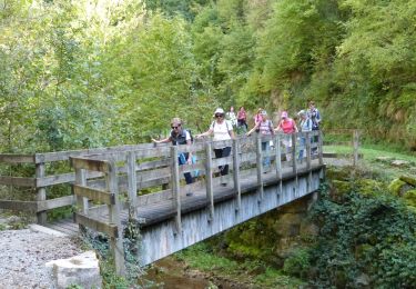
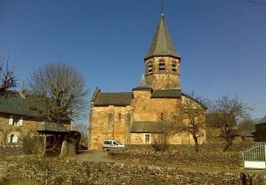
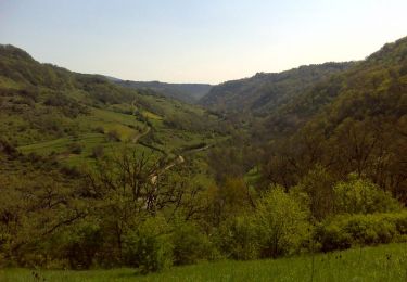
Randonnée A pied de 3,9 km à découvrir à Occitanie, Aveyron, Bozouls. Cette randonnée est proposée par Strabidja.

Description

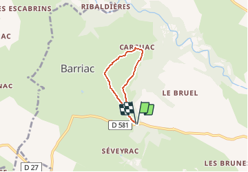
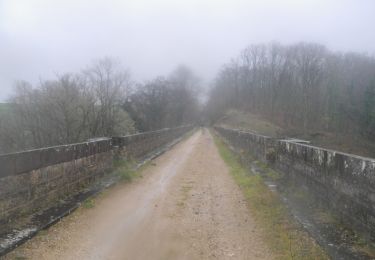
Petite marche  tranquille de 4 km, entièrement par un chemin large sauf depuis "CARCUAC" où vous suivrez la route de campagne, où nous n'avons croisé aucune voiture, sur environ 800m avant de reprendre à droite pour faire la boucle...

Profil altimétrique

Photos

Localisation

Pays :
France
Région :
Occitanie
Département/Province :
Aveyron
Commune :
Bozouls
Localité :
Unknown
Départ:(UTM)
474292 ; 4922994 (31T) N.

Randonnées à proximité

Randonnée A pied Sébazac-Concourès - Circuit 17 Concourès - Photo
A pied
PRO

A pied

Facile
Sébazac-Concourès, Occitanie, Aveyron, France
9 km | 10,6 km-effort
2h 24min
Oui
Randonnée Marche Rodelle - BEZONNES Nord - Photo
Marche
Strabidja

Marche

Moyen
(1)
Rodelle, Occitanie, Aveyron, France
6 km | 6,3 km-effort
1h 25min
Oui
Randonnée Marche Bozouls - Trou de Bozouls - Photo
Marche
jmpu

Marche

Facile
(4)
Bozouls, Occitanie, Aveyron, France
14,5 km | 19,9 km-effort
4h 15min
Oui
Randonnée V.T.T. Rodelle - Ledenac 2 - Photo
V.T.T.
bonnetchristian

V.T.T.

Très facile
(1)
Rodelle, Occitanie, Aveyron, France
5,5 km | 6,8 km-effort
Inconnu
Non
Randonnée A pied Bozouls - De Bozouls à Rodelle - Photo
A pied
PRO

A pied

Facile
Bozouls, Occitanie, Aveyron, France
10,4 km | 13,6 km-effort
3h 4min
Non
Randonnée Marche Bozouls - Bozoul (Après-midi) - Photo
Marche
jesusmarieclaire

Marche

Facile
Bozouls, Occitanie, Aveyron, France
4,8 km | 6,6 km-effort
2h 0min
Oui
Randonnée Marche Bozouls - Horizons et Clochers du Rouergue - Gillorgues - Photo
Marche
tracegps

Marche

Moyen
Bozouls, Occitanie, Aveyron, France
11,9 km | 15,5 km-effort
3h 0min
Oui
Randonnée Marche Bozouls - De Barriac à Rodelle - Photo
Marche
tracegps

Marche

Moyen
Bozouls, Occitanie, Aveyron, France
12,3 km | 16,5 km-effort
3h 15min
Oui
Randonnée V.T.T. Bozouls - Roquelaure au départ de Bozouls - Photo
V.T.T.
tracegps

V.T.T.

Difficile
Bozouls, Occitanie, Aveyron, France
33 km | 43 km-effort
4h 19min
Oui


Fermer
Mes abonnements