Randonnée Marche Bouxières-aux-Bois - Bouxieres-aux-bois : Le circuit de Virine - Photo

Bouxieres-aux-bois : Le circuit de Virine

 ABICHE
ABICHE

Utilisateur

© OpenStreetMap contributors
Longueur
Longueur
14,2 km
Altitude max
Altitude max
457 m
Dénivelé positif
Dénivelé positif
309 m
Km-Effort
Km-Effort  
18,3 km
Altitude min
Altitude min
309 m
Dénivelé négatif
Dénivelé négatif
309 m
Boucle
Boucle
Oui
Date de création :
2019-04-09 08:36:16.88
Dernière modification :
2019-04-09 19:33:18.42

(0 Avis)

Marche
Marche
5h07
Difficulté : Très facile

Scannez ce code QR pour ouvrir la randonnée dans l'application SityTrail

Application GPS de randonnée GRATUITE

Logo SityTrail SityTrail

IGN / Instituts géographiques

Télécharger SityTrail sur l'App Store Télécharger SityTrail sur Google Play

Logo SityTrail SityTrail World

Le monde est à vous

Télécharger SityTrail sur l'App Store Télécharger SityTrail sur Google Play Télécharger SityTrail sur Huawei AppGallery

À propos

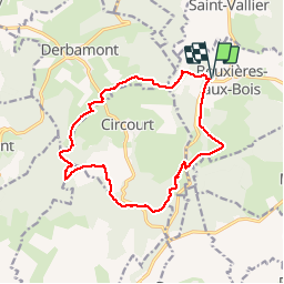
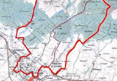
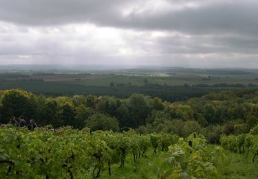
Randonnée Marche de 14,2 km à découvrir à Grand Est, Vosges, Bouxières-aux-Bois. Cette randonnée est proposée par ABICHE.

Description

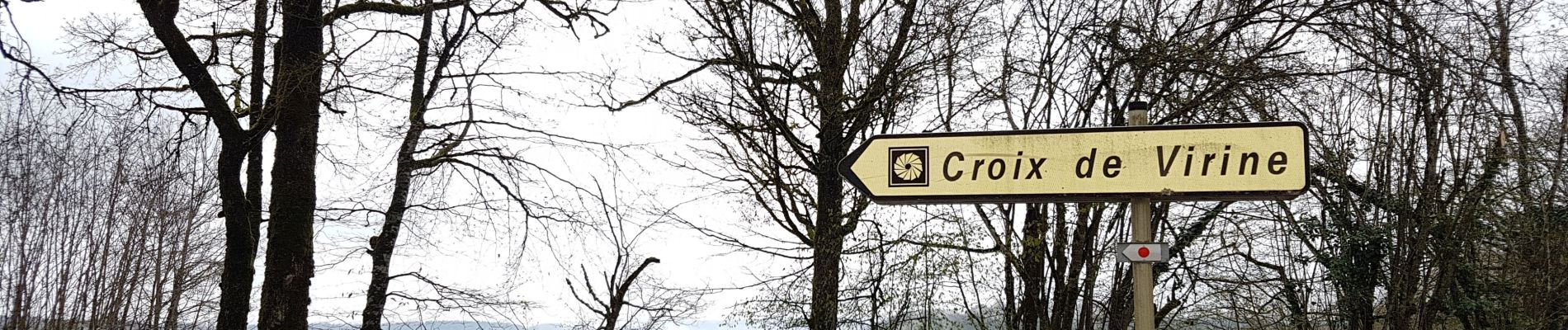
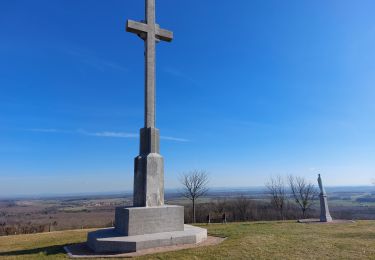
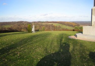
Belle randonnée mais à ne pas faire par temps de pluie car certaines parties sont très boueuses. Table d'orientation près de la croix à voir par temps dégagé.

Profil altimétrique

Photos

Localisation

Pays :
France
Région :
Grand Est
Département/Province :
Vosges
Commune :
Bouxières-aux-Bois
Localité :
Unknown
Départ:(UTM)
300364 ; 5349076 (32U) N.

Randonnées à proximité

Randonnée A pied Bouxières-aux-Bois - Circuit des Fontaines et Lavoirs - Photo
A pied
PRO

A pied

Facile
Bouxières-aux-Bois, Grand Est, Vosges, France
15 km | 18,8 km-effort
4h 15min
Oui
Randonnée A pied Derbamont - Circuit des Deux Vallons - Photo
A pied
PRO

A pied

Facile
Derbamont, Grand Est, Vosges, France
12,3 km | 15,8 km-effort
3h 36min
Oui
Randonnée A pied Gugney-aux-Aulx - Circuit des Mirabelliers - Photo
A pied
PRO

A pied

Facile
(1)
Gugney-aux-Aulx, Grand Est, Vosges, France
7,3 km | 9,7 km-effort
2h 12min
Oui
Randonnée Marche Circourt - Circourt - Photo
Marche
triburemy

Marche

Difficile
Circourt, Grand Est, Vosges, France
7,4 km | 10 km-effort
1h 53min
Oui
Randonnée Marche Mazeley - chanot  - Photo
Marche
ACPL

Marche

Moyen
Mazeley, Grand Est, Vosges, France
9,8 km | 11 km-effort
4h 25min
Non
Randonnée Marche Bouzemont - Circuit de Bouzemont - Dompaire - Photo
Marche
tracegps

Marche

Difficile
Bouzemont, Grand Est, Vosges, France
14 km | 17,2 km-effort
3h 30min
Oui
Randonnée Marche Circourt - Circuit de Virine - Circourt - Photo
Marche
tracegps

Marche

Moyen
Circourt, Grand Est, Vosges, France
13,6 km | 17,6 km-effort
3h 0min
Oui
Randonnée Marche Circourt - Circuit de Circourt - Photo
Marche
tracegps

Marche

Facile
Circourt, Grand Est, Vosges, France
5,8 km | 7,7 km-effort
1h 0min
Oui
Randonnée Marche Bouzemont - Circuit de la Madonne et Lamerey - Photo
Marche
tracegps

Marche

Facile
Bouzemont, Grand Est, Vosges, France
9,5 km | 11,9 km-effort
1h 19min
Oui


Fermer
Mes abonnements