Randonnée Voiture Kelheim - Walhalla - Photo
 jcm17
jcm17

Utilisateur

© OpenStreetMap contributors
Longueur
Longueur
42 km
Altitude max
Altitude max
449 m
Dénivelé positif
Dénivelé positif
488 m
Km-Effort
Km-Effort  
48 km
Altitude min
Altitude min
324 m
Dénivelé négatif
Dénivelé négatif
443 m
Boucle
Boucle
Non
Date de création :
2019-05-12 11:33:59.236
Dernière modification :
2019-05-12 15:37:56.983

(0 Avis)

Voiture
Voiture
42m
Difficulté : Très facile

Scannez ce code QR pour ouvrir la randonnée dans l'application SityTrail

Application GPS de randonnée GRATUITE

Logo SityTrail SityTrail

IGN / Instituts géographiques

Télécharger SityTrail sur l'App Store Télécharger SityTrail sur Google Play

Logo SityTrail SityTrail World

Le monde est à vous

Télécharger SityTrail sur l'App Store Télécharger SityTrail sur Google Play Télécharger SityTrail sur Huawei AppGallery

À propos

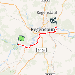
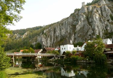
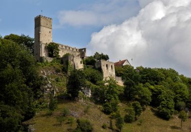
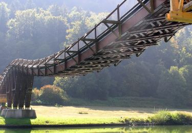
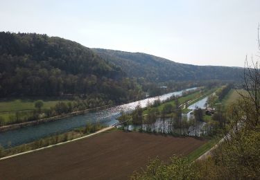
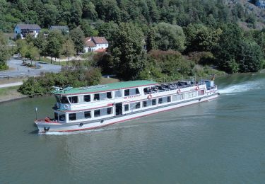
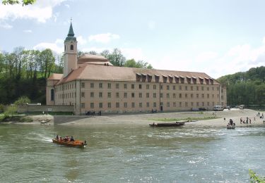
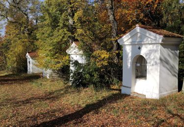
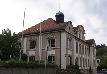
Randonnée Voiture de 42 km à découvrir à Bavière, Landkreis Kelheim, Kelheim. Cette randonnée est proposée par jcm17.

Profil altimétrique

Localisation

Pays :
Allemagne
Région :
Bavière
Département/Province :
Landkreis Kelheim
Commune :
Kelheim
Localité :
Unknown
Départ:(UTM)
708871 ; 5422854 (32U) N.

Randonnées à proximité

Randonnée A pied Essing - Rundweg Essing 21 - Photo
A pied
PRO

A pied

Facile
Essing, Bavière, Landkreis Kelheim, Allemagne
6,9 km | 9,8 km-effort
2h 13min
Non
Randonnée A pied Essing - Rundweg Essing 6 - Photo
A pied
PRO

A pied

Facile
Essing, Bavière, Landkreis Kelheim, Allemagne
12,9 km | 17,3 km-effort
3h 56min
Non
Randonnée A pied Essing - Rundweg Essing 4 - Photo
A pied
PRO

A pied

Facile
Essing, Bavière, Landkreis Kelheim, Allemagne
6,8 km | 8,9 km-effort
2h 1min
Oui
Randonnée A pied Essing - Rundweg Essing 2 - Photo
A pied
PRO

A pied

Facile
Essing, Bavière, Landkreis Kelheim, Allemagne
5,3 km | 7,7 km-effort
1h 44min
Non
Randonnée A pied Essing - Rundweg Essing 1 - Photo
A pied
PRO

A pied

Facile
Essing, Bavière, Landkreis Kelheim, Allemagne
4,8 km | 7,2 km-effort
1h 38min
Oui
Randonnée A pied Hienheimer Forst - Rundweg Riedenburg 16 - Photo
A pied
PRO

A pied

Facile
Hienheimer Forst, Bavière, Landkreis Kelheim, Allemagne
9,3 km | 12,5 km-effort
2h 50min
Non
Randonnée A pied Kelheim - Ortswanderweg Kelheim 4 - Photo
A pied
PRO

A pied

Facile
Kelheim, Bavière, Landkreis Kelheim, Allemagne
7,8 km | 10,8 km-effort
2h 27min
Oui
Randonnée A pied Ihrlerstein - Ortswanderweg Ihrlerstein - Photo
A pied
PRO

A pied

Facile
Ihrlerstein, Bavière, Landkreis Kelheim, Allemagne
10,6 km | 14,4 km-effort
3h 16min
Non
Randonnée A pied Kelheim - W ... Kelheim - Weltenburg (Rotes Dreieck) - Photo
A pied
PRO

A pied

Facile
Kelheim, Bavière, Landkreis Kelheim, Allemagne
4,4 km | 6,2 km-effort
1h 25min
Non


Fermer
Mes abonnements