Randonnée Randonnée équestre Promilhanes - lac de lacabru - Photo
 patricecubaynes
patricecubaynes

Utilisateur

© OpenStreetMap contributors
Longueur
Longueur
24 km
Altitude max
Altitude max
398 m
Dénivelé positif
Dénivelé positif
360 m
Km-Effort
Km-Effort  
28 km
Altitude min
Altitude min
308 m
Dénivelé négatif
Dénivelé négatif
362 m
Boucle
Boucle
Oui
Date de création :
2019-05-18 05:34:10.644
Dernière modification :
2019-07-11 21:48:32.875

(0 Avis)

Randonnée équestre
Randonnée équestre
3h34
Difficulté : Moyen

Scannez ce code QR pour ouvrir la randonnée dans l'application SityTrail

Application GPS de randonnée GRATUITE

Logo SityTrail SityTrail

IGN / Instituts géographiques

Télécharger SityTrail sur l'App Store Télécharger SityTrail sur Google Play

Logo SityTrail SityTrail World

Le monde est à vous

Télécharger SityTrail sur l'App Store Télécharger SityTrail sur Google Play Télécharger SityTrail sur Huawei AppGallery

À propos

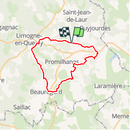
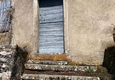
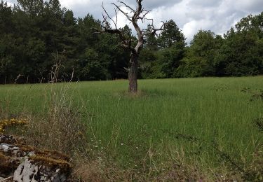
Randonnée Randonnée équestre de 24 km à découvrir à Occitanie, Lot, Promilhanes. Cette randonnée est proposée par patricecubaynes.

Description

ARET 19-05-19

Profil altimétrique

Points d'intérêt

Point d'intérêt Promilhanes - Lac de Lacabru - Photo
patricecubaynes
PROMILHANES 

Localisation

Pays :
France
Région :
Occitanie
Département/Province :
Lot
Commune :
Promilhanes
Localité :
Unknown
Départ:(Dec)
Départ:(UTM)
406683 ; 4916127 (31T) N.

Randonnées à proximité

Randonnée Marche Limogne-en-Quercy - Limogne Malecargue variante  - Photo
Marche
GUIDE
antignacs

Marche

Très facile
(1)
Limogne-en-Quercy, Occitanie, Lot, France
9,7 km | 11,8 km-effort
2h 14min
Oui
Randonnée Marche Saint-Jean-de-Laur - Saint Jacques Étape 15 - Photo
Marche
Jean-MarieFaux

Marche

Très facile
(1)
Saint-Jean-de-Laur, Occitanie, Lot, France
26 km | 31 km-effort
7h 8min
Non
Randonnée Marche Limogne-en-Quercy - Mon Compostelle septième étape - Photo
Marche
Ardeiserois

Marche

Difficile
Limogne-en-Quercy, Occitanie, Lot, France
49 km | 61 km-effort
10h 30min
Non
Randonnée Marche Beauregard - Beauregard - Mas de Poussau - Photo
Marche
MM46

Marche

Très facile
Beauregard, Occitanie, Lot, France
4,4 km | 5,3 km-effort
56min
Oui
Randonnée Marche Limogne-en-Quercy - Lac Aurié et dolmen - Photo
Marche
clotioneb

Marche

Très facile
Limogne-en-Quercy, Occitanie, Lot, France
5,5 km | 6,9 km-effort
1h 14min
Oui
Randonnée Marche Limogne-en-Quercy - Fontaine de Malecargue - Photo
Marche
clotioneb

Marche

Très facile
Limogne-en-Quercy, Occitanie, Lot, France
4,5 km | 5,5 km-effort
53min
Oui
Randonnée Marche Limogne-en-Quercy - circuit des cabanes Limogne - Photo
Marche
hartmannpat

Marche

Facile
Limogne-en-Quercy, Occitanie, Lot, France
3,4 km | 3,9 km-effort
1h 30min
Oui
Randonnée Marche Saint-Jean-de-Laur - Limogne au nord-est  - Photo
Marche
GUIDE
antignacs

Marche

Facile
Saint-Jean-de-Laur, Occitanie, Lot, France
15,6 km | 19,2 km-effort
3h 37min
Oui
Randonnée Marche Limogne-en-Quercy - Limogne-en-Quercy - Mas de Coutal - Photo
Marche
MM46

Marche

Très facile
(1)
Limogne-en-Quercy, Occitanie, Lot, France
4,8 km | 5,7 km-effort
1h 14min
Oui


Fermer
Mes abonnements