


RS-Beaucroissant-Les étangs

raymondfn
Utilisateur
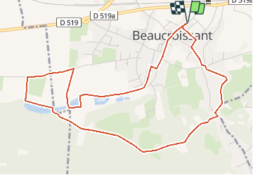

Longueur
6,1 km

Altitude max
477 m

Dénivelé positif
75 m
Km-Effort
7,1 km

Altitude min
420 m

Dénivelé négatif
75 m
Boucle
Oui
Date de création :
2019-06-14 13:52:12.484
Dernière modification :
2021-01-07 15:22:19.284
47m
Difficulté : Facile

Application GPS de randonnée GRATUITE
 SityTrail
IGN / Instituts géographiques
SityTrail Plus
Le monde est à vous
À propos
Randonnée Marche de 6,1 km à découvrir à Auvergne-Rhône-Alpes, Isère, Beaucroissant. Cette randonnée est proposée par raymondfn.
Description
Rando Santé
Localisation
Pays :
France
Région :
Auvergne-Rhône-Alpes
Département/Province :
Isère
Commune :
Beaucroissant
Localité :
Unknown
Départ:(Dec)
Départ:(UTM)
693698 ; 5023906 (31T) N.
Commentaires