


2019-09-06 WE CVA 40Ans St Pierre Bellefosse

holtzv
Utilisateur GUIDE
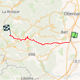

Longueur
25 km

Altitude max
1012 m

Dénivelé positif
1013 m
Km-Effort
37 km

Altitude min
173 m

Dénivelé négatif
515 m
Boucle
Non
Date de création :
2019-09-02 15:19:01.725
Dernière modification :
2019-09-02 15:20:31.361
4h40
Difficulté : Difficile

Application GPS de randonnée GRATUITE
 SityTrail
IGN / Instituts géographiques
SityTrail Plus
Le monde est à vous
À propos
Randonnée Randonnée équestre de 25 km à découvrir à Grand Est, Bas-Rhin, Stotzheim. Cette randonnée est proposée par holtzv.
Localisation
Pays :
France
Région :
Grand Est
Département/Province :
Bas-Rhin
Commune :
Stotzheim
Localité :
Unknown
Départ:(Dec)
Départ:(UTM)
386935 ; 5359565 (32U) N.
Commentaires