


lanchatra

Liebeaux
Utilisateur
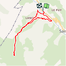

Longueur
10,9 km

Altitude max
1811 m

Dénivelé positif
710 m
Km-Effort
20 km

Altitude min
1187 m

Dénivelé négatif
711 m
Boucle
Oui
Date de création :
2019-10-03 06:42:05.136
Dernière modification :
2019-10-03 13:19:25.329
6h35
Difficulté : Très facile

Application GPS de randonnée GRATUITE
 SityTrail
IGN / Instituts géographiques
SityTrail Plus
Le monde est à vous
À propos
Randonnée Marche de 10,9 km à découvrir à Auvergne-Rhône-Alpes, Isère, Saint-Christophe-en-Oisans. Cette randonnée est proposée par Liebeaux.
Localisation
Pays :
France
Région :
Auvergne-Rhône-Alpes
Département/Province :
Isère
Commune :
Saint-Christophe-en-Oisans
Localité :
Unknown
Départ:(Dec)
Départ:(UTM)
275649 ; 4983334 (32T) N.
Commentaires