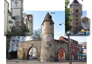
4,2 km | 4,6 km-effort
illzach
jbclevenot
Utilisateur
Longueur
9,4 km
Altitude max
242 m
Dénivelé positif
53 m
Km-Effort
10,1 km
Altitude min
226 m
Dénivelé négatif
55 m
Boucle
Oui
Date de création :
2019-10-04 05:03:37.651
Dernière modification :
2019-10-04 07:04:29.568
2h00
Difficulté : Très facile
Application GPS de randonnée GRATUITE
À propos
Randonnée V.T.C. de 9,4 km à découvrir à Grand Est, Haut-Rhin, Illzach. Cette randonnée est proposée par jbclevenot.
Localisation
Pays :
France
Région :
Grand Est
Département/Province :
Haut-Rhin
Commune :
Illzach
Localité :
Unknown
Départ:(Dec)
Départ:(UTM)
376682 ; 5292889 (32T) N.
Commentaires
Randonnées à proximité
Promenade circulaire - Noennenbruch - Anneau rouge
A pied
Facile
Lutterbach,
Grand Est,
Haut-Rhin,
France
6,6 km | 7,3 km-effort
1h 39min
Non
Anneau rouge
A pied
Facile
Mulhouse,
Grand Est,
Haut-Rhin,
France
7,4 km | 9,7 km-effort
2h 11min
Oui
Mulhouse / Ferrette..02/05/2024..les Marcheurs
Marche
Très difficile
Riedisheim,
Grand Est,
Haut-Rhin,
France
37 km | 48 km-effort
4h 9min
Non
Rebbargala Wittenheim
Marche
Facile
Kingersheim,
Grand Est,
Haut-Rhin,
France
5,3 km | 5,7 km-effort
1h 19min
Oui
circuit circulaire du Rothlaub
Marche
Très facile
Riedisheim,
Grand Est,
Haut-Rhin,
France
8,3 km | 10,7 km-effort
1h 45min
Oui
promenade champêtre
Autre activité
Très facile
Rixheim,
Grand Est,
Haut-Rhin,
France
6,4 km | 8 km-effort
1h 50min
Oui
Grand Est - Ligne 4 - Paris Mulhouse (section de :Montreux-Vieux à Mulhouse)
Autre activité
Très facile
Mulhouse,
Grand Est,
Haut-Rhin,
France
36 km | 39 km-effort
5min
Non
JD 17/20 Collines de Habsheim
Marche
Rixheim,
Grand Est,
Haut-Rhin,
France
7,7 km | 9,7 km-effort
2h 0min
Oui