Randonnée Course à pied Montpezat - CRÊTES - Photo
 gas
gas

Utilisateur

© OpenStreetMap contributors
Longueur
Longueur
9,1 km
Altitude max
Altitude max
179 m
Dénivelé positif
Dénivelé positif
227 m
Km-Effort
Km-Effort  
12,1 km
Altitude min
Altitude min
73 m
Dénivelé négatif
Dénivelé négatif
225 m
Boucle
Boucle
Oui
Date de création :
2019-10-06 08:27:44.0
Dernière modification :
2019-10-06 09:38:56.206

(0 Avis)

Course à pied
Course à pied
1h12
Difficulté : Difficile

Scannez ce code QR pour ouvrir la randonnée dans l'application SityTrail

Application GPS de randonnée GRATUITE

Logo SityTrail SityTrail

IGN / Instituts géographiques

Télécharger SityTrail sur l'App Store Télécharger SityTrail sur Google Play

Logo SityTrail SityTrail World

Le monde est à vous

Télécharger SityTrail sur l'App Store Télécharger SityTrail sur Google Play Télécharger SityTrail sur Huawei AppGallery

À propos

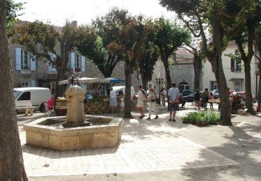
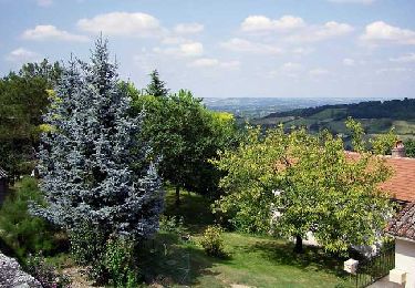
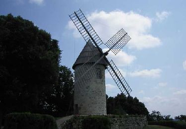
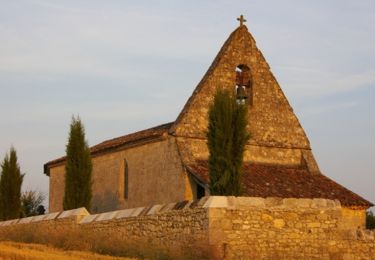
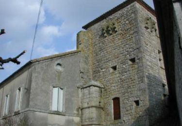
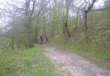
Randonnée Course à pied de 9,1 km à découvrir à Nouvelle-Aquitaine, Lot-et-Garonne, Montpezat. Cette randonnée est proposée par gas.

Profil altimétrique

Localisation

Pays :
France
Région :
Nouvelle-Aquitaine
Département/Province :
Lot-et-Garonne
Commune :
Montpezat
Localité :
Unknown
Départ:(Dec)
Départ:(UTM)
304714 ; 4911515 (31T) N.

Randonnées à proximité

Randonnée Marche Prayssas - Prayssas, le circuit des pigeonniers - Pays de la vallée du Lot - Photo
Marche
tracegps

Marche

Moyen
(3)
Prayssas, Nouvelle-Aquitaine, Lot-et-Garonne, France
12,1 km | 15,9 km-effort
2h 30min
Oui
Randonnée Marche Montpezat - Montpezat-d'Agenais, par St-Médard et Saint-Jean-de-la-Balerme - Pays de la vallée du Lot - Photo
Marche
tracegps

Marche

Moyen
(1)
Montpezat, Nouvelle-Aquitaine, Lot-et-Garonne, France
10,7 km | 14,8 km-effort
3h 0min
Oui
Randonnée Marche Montpezat - Montpezat-d'Agenais, le circuit du moulin à vent - Pays de la vallée du Lot - Photo
Marche
tracegps

Marche

Moyen
(2)
Montpezat, Nouvelle-Aquitaine, Lot-et-Garonne, France
10,5 km | 14,1 km-effort
2h 45min
Oui
Randonnée Marche Laugnac - De Laugnac  à Cours, un long circuit dans les Serres - Pays de la vallée du Lot - Photo
Marche
tracegps

Marche

Difficile
(2)
Laugnac, Nouvelle-Aquitaine, Lot-et-Garonne, France
21 km | 28 km-effort
5h 15min
Oui
Randonnée A pied Prayssas - Prayssas, tourisme au pays du chasselas - 9km - Photo
A pied
PRO

A pied

Facile
Prayssas, Nouvelle-Aquitaine, Lot-et-Garonne, France
9 km | 12,3 km-effort
2h 48min
Non
Randonnée V.T.T. Prayssas - Lac de Néguenou à Montpezat - Photo
V.T.T.
tracegps

V.T.T.

Très difficile
Prayssas, Nouvelle-Aquitaine, Lot-et-Garonne, France
43 km | 54 km-effort
4h 0min
Oui
Randonnée V.T.T. Dolmayrac - Dolmayrac / Laugnac, une grande randonnée dans les Serres - Photo
V.T.T.
tracegps

V.T.T.

Difficile
Dolmayrac, Nouvelle-Aquitaine, Lot-et-Garonne, France
27 km | 35 km-effort
3h 34min
Oui
Randonnée Marche Dolmayrac - Dolmayrac / Laugnac, une grande randonnée dans les Serres - Photo
Marche
tracegps

Marche

Difficile
Dolmayrac, Nouvelle-Aquitaine, Lot-et-Garonne, France
27 km | 35 km-effort
7h 15min
Oui
Randonnée V.T.T. Prayssas - Parcours de Prayssas - Photo
V.T.T.
tracegps

V.T.T.

Très difficile
Prayssas, Nouvelle-Aquitaine, Lot-et-Garonne, France
59 km | 77 km-effort
4h 30min
Oui


Fermer
Mes abonnements