Randonnée Marche Kerbors - Presqu'ile du Trieux - Photo

Club Rando Saint-Paër

© OpenStreetMap contributors
Longueur
Longueur
12,8 km
Altitude max
Altitude max
46 m
Dénivelé positif
Dénivelé positif
132 m
Km-Effort
Km-Effort  
14,6 km
Altitude min
Altitude min
-1 m
Dénivelé négatif
Dénivelé négatif
133 m
Boucle
Boucle
Oui
Date de création :
2019-11-20 15:12:06.816
Dernière modification :
2020-03-30 11:41:09.823

(1 Avis)

Marche
Marche
3h12
Difficulté : Facile

Scannez ce code QR pour ouvrir la randonnée dans l'application SityTrail

Application GPS de randonnée GRATUITE

Logo SityTrail SityTrail

IGN / Instituts géographiques

Télécharger SityTrail sur l'App Store Télécharger SityTrail sur Google Play

Logo SityTrail SityTrail World

Le monde est à vous

Télécharger SityTrail sur l'App Store Télécharger SityTrail sur Google Play Télécharger SityTrail sur Huawei AppGallery

À propos

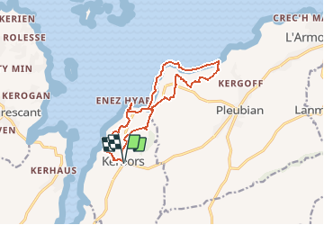
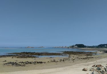
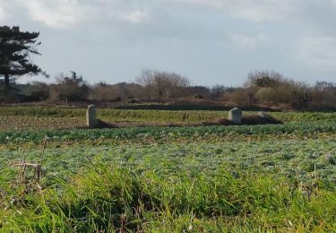
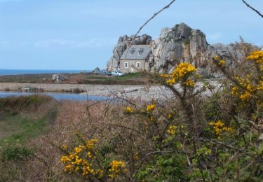
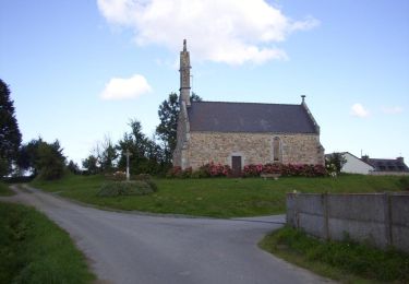
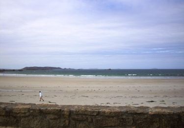
Randonnée Marche de 12,8 km à découvrir à Bretagne, Côtes-d'Armor, Kerbors. Cette randonnée est proposée par BOUSSOLE ET SAC A DOS.

Description

Randonnée assez facile
Indice d'effort : 2/5

Profil altimétrique

Localisation

Pays :
France
Région :
Bretagne
Département/Province :
Côtes-d'Armor
Commune :
Kerbors
Localité :
Unknown
Départ:(UTM)
486575 ; 5408374 (30U) N.

Commentaires

Veuillez vous connecter pour laisser un commentaire ou une note


Randonnées à proximité

Randonnée Vélo électrique Tréguier - Tour de la pointe de Plougrescrant à partir de Treguier - Photo
Vélo électrique
EricVIBERT

Vélo électrique

Facile
Tréguier, Bretagne, Côtes-d'Armor, France
32 km | 37 km-effort
3h 38min
Non
Randonnée Marche Plougrescant - Le grand tour de Plougrescant - Photo
Marche
ilur56

Marche

Moyen
Plougrescant, Bretagne, Côtes-d'Armor, France
16,1 km | 18,2 km-effort
4h 7min
Oui
Randonnée Marche Plouguiel - Bugelez - Photo
Marche
nolsim

Marche

Facile
Plouguiel, Bretagne, Côtes-d'Armor, France
18,3 km | 20 km-effort
5h 7min
Non
Randonnée Marche Pleubian - Le GR 34 entre les menhirs de Pleubian et Trédarzec (Ker an Trez) - Photo
Marche
ace003

Marche

Facile
Pleubian, Bretagne, Côtes-d'Armor, France
17,7 km | 21 km-effort
3h 45min
Non
Randonnée Marche Plougrescant - Grand tour de Plougrescant - Photo
Marche
tracegps

Marche

Moyen
Plougrescant, Bretagne, Côtes-d'Armor, France
17,8 km | 20 km-effort
5h 10min
Oui
Randonnée Marche Plougrescant - Randoguide - Photo
Marche
raivavae

Marche

Facile
(1)
Plougrescant, Bretagne, Côtes-d'Armor, France
7,7 km | 8,8 km-effort
5min
Oui
Randonnée Marche Plougrescant - Plougrescant - Photo
Marche
jayetc

Marche

Très facile
(1)
Plougrescant, Bretagne, Côtes-d'Armor, France
13,1 km | 15,1 km-effort
Inconnu
Oui
Randonnée Marche Plougrescant - Autour de Tréguier - Etape 4 - Photo
Marche
tracegps

Marche

Moyen
Plougrescant, Bretagne, Côtes-d'Armor, France
17,3 km | 21 km-effort
4h 45min
Non
Randonnée Marche Tréguier - Autour de Tréguier - Etape 1 - Photo
Marche
tracegps

Marche

Moyen
Tréguier, Bretagne, Côtes-d'Armor, France
16,8 km | 19,9 km-effort
4h 15min
Non


Fermer
Mes abonnements