Randonnée Marche nordique Stein - Veer Berg ad Maas Leut Kasteel Vilain XIIII - Photo

Veer Berg ad Maas Leut Kasteel Vilain XIIII

 jos.wessels
jos.wessels

Utilisateur

© OpenStreetMap contributors
Longueur
Longueur
11,7 km
Altitude max
Altitude max
44 m
Dénivelé positif
Dénivelé positif
72 m
Km-Effort
Km-Effort  
12,7 km
Altitude min
Altitude min
27 m
Dénivelé négatif
Dénivelé négatif
72 m
Boucle
Boucle
Oui
Date de création :
2014-12-10 00:00:00.0
Dernière modification :
2014-12-10 00:00:00.0

(0 Avis)

Marche nordique
Marche nordique
3h08
Difficulté : Très facile

Scannez ce code QR pour ouvrir la randonnée dans l'application SityTrail

Application GPS de randonnée GRATUITE

Logo SityTrail SityTrail

IGN / Instituts géographiques

Télécharger SityTrail sur l'App Store Télécharger SityTrail sur Google Play

Logo SityTrail SityTrail World

Le monde est à vous

Télécharger SityTrail sur l'App Store Télécharger SityTrail sur Google Play Télécharger SityTrail sur Huawei AppGallery

À propos

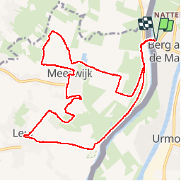
Randonnée Marche nordique de 11,7 km à découvrir à Limbourg, Inconnu, Stein. Cette randonnée est proposée par jos.wessels.

Description

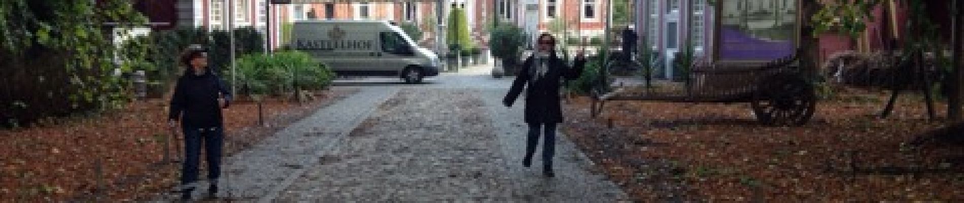
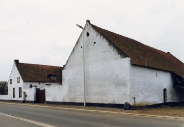
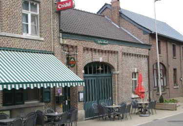
Mooie wandeling langs de grensmaas met lunch in kasteel Vilain XIIII.

Profil altimétrique

Photos

Localisation

Pays :
Pays-Bas
Région :
Limbourg
Département/Province :
Inconnu
Commune :
Stein
Localité :
Unknown
Départ:(Dec)
Départ:(UTM)
694181 ; 5654166 (31U) N.

Randonnées à proximité

Randonnée A pied Dilsen-Stokkem - Stokkem & Oud-Dilsen Blauwe ruit - Photo
A pied
PRO

A pied

Facile
Dilsen-Stokkem, Flandre, Limbourg, Belgique
4,7 km | 5 km-effort
1h 8min
Oui
Randonnée A pied Maasmechelen - Leut & Meeswijk Oranje bol - Photo
A pied
PRO

A pied

Facile
Maasmechelen, Flandre, Limbourg, Belgique
10,3 km | 11,2 km-effort
2h 33min
Oui
Randonnée A pied Maasmechelen - Leut & Meeswijk Rode driehoek - Photo
A pied
PRO

A pied

Facile
Maasmechelen, Flandre, Limbourg, Belgique
14 km | 15 km-effort
3h 24min
Oui
Randonnée A pied Maasmechelen - Leut & Meeswijk Gele zeshoek - Photo
A pied
PRO

A pied

Facile
Maasmechelen, Flandre, Limbourg, Belgique
7 km | 7,4 km-effort
1h 40min
Oui
Randonnée A pied Maasmechelen - Leut & Meeswijk Groene rechthoek - Photo
A pied
PRO

A pied

Facile
Maasmechelen, Flandre, Limbourg, Belgique
3,5 km | 3,9 km-effort
53min
Oui
Randonnée A pied Maasmechelen - Leut & Meeswijk Blauwe ruit - Photo
A pied
PRO

A pied

Facile
Maasmechelen, Flandre, Limbourg, Belgique
5 km | 5,6 km-effort
1h 15min
Oui
Randonnée A pied Dilsen-Stokkem - Stokkem & Oud-Dilsen Oranje bol - Photo
A pied
PRO

A pied

Facile
Dilsen-Stokkem, Flandre, Limbourg, Belgique
5,4 km | 5,9 km-effort
1h 20min
Oui
Randonnée A pied Dilsen-Stokkem - Stokkem & Oud-Dilsen Rode driehoek - Photo
A pied
PRO

A pied

Facile
Dilsen-Stokkem, Flandre, Limbourg, Belgique
9,5 km | 10,3 km-effort
2h 21min
Non
Randonnée Marche Maasmechelen - Maasmechelen - Site minier Connecterra - Photo
Marche
GUIDE
mumu.larandonneuse

Marche

Facile
(1)
Maasmechelen, Flandre, Limbourg, Belgique
17,2 km | 21 km-effort
3h 52min
Oui


Fermer
Mes abonnements