


Montecot 10.32

togolo28
Utilisateur
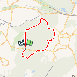

Longueur
10,4 km

Altitude max
259 m

Dénivelé positif
89 m
Km-Effort
11,6 km

Altitude min
209 m

Dénivelé négatif
89 m
Boucle
Oui
Date de création :
2017-04-27 00:00:00.0
Dernière modification :
2017-04-27 00:00:00.0
2h34
Difficulté : Très facile

Application GPS de randonnée GRATUITE
 SityTrail
IGN / Instituts géographiques
SityTrail Plus
Le monde est à vous
À propos
Randonnée Marche de 10,4 km à découvrir à Centre-Val de Loire, Eure-et-Loir, Le Favril. Cette randonnée est proposée par togolo28.
Localisation
Pays :
France
Région :
Centre-Val de Loire
Département/Province :
Eure-et-Loir
Commune :
Le Favril
Localité :
Unknown
Départ:(Dec)
Départ:(UTM)
357824 ; 5368467 (31U) N.
Commentaires