


GASPARD PORT DES PLANCHES...

surceneux
Utilisateur
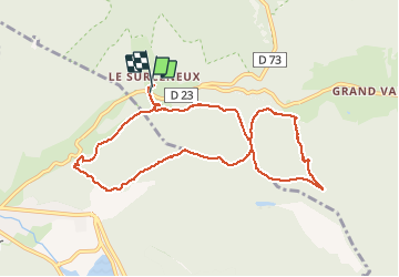

Longueur
9,3 km

Altitude max
937 m

Dénivelé positif
325 m
Km-Effort
13,7 km

Altitude min
762 m

Dénivelé négatif
322 m
Boucle
Oui
Date de création :
2020-02-02 13:53:00.271
Dernière modification :
2020-02-02 16:12:21.264
2h00
Difficulté : Très facile

Application GPS de randonnée GRATUITE
 SityTrail
IGN / Instituts géographiques
SityTrail Plus
Le monde est à vous
À propos
Randonnée Marche de 9,3 km à découvrir à Grand Est, Vosges, Ban-sur-Meurthe-Clefcy. Cette randonnée est proposée par surceneux.
Description
GASPARD PORT DES PLANCHES CHARBONNIER VIA CASUETTE ET MILIEU SCHMALICK PORT DES PLANCHES LES BROCHES ALLEE BRIMBELLES TRAVERSE JDS SURCENEUX
Localisation
Pays :
France
Région :
Grand Est
Département/Province :
Vosges
Commune :
Ban-sur-Meurthe-Clefcy
Localité :
Unknown
Départ:(Dec)
Départ:(UTM)
347802 ; 5328972 (32U) N.
Commentaires