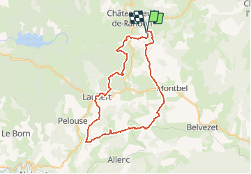
38 km | 47 km-effort
Boucle Etoile du Château ( Hotel de la Poste)
Lozère Cheval
Utilisateur
Longueur
31 km
Altitude max
1336 m
Dénivelé positif
657 m
Km-Effort
40 km
Altitude min
1134 m
Dénivelé négatif
663 m
Boucle
Oui
Date de création :
2020-05-07 18:29:50.03
Dernière modification :
2021-01-15 08:11:03.271
--
Difficulté : Inconnu
Application GPS de randonnée GRATUITE
À propos
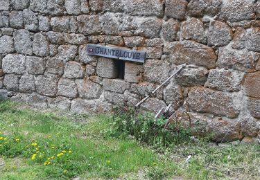
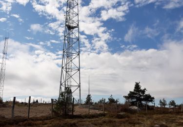
Randonnée Randonnée équestre de 31 km à découvrir à Occitanie, Lozère, Châteauneuf-de-Randon. Cette randonnée est proposée par Lozère Cheval.
Localisation
Pays :
France
Région :
Occitanie
Département/Province :
Lozère
Commune :
Châteauneuf-de-Randon
Localité :
Unknown
Départ:(Dec)
Départ:(UTM)
554768 ; 4942130 (31T) N.
Commentaires
Randonnées à proximité
2022-09-18 Rando CVA Lozere Chateauneuf de Randon vers Chasserades
Randonnée équestre
Moyen
Châteauneuf-de-Randon,
Occitanie,
Lozère,
France
31 km | 42 km-effort
5h 20min
Non
col du cheval mort
Vélo de route
Moyen
Châteauneuf-de-Randon,
Occitanie,
Lozère,
France
52 km | 63 km-effort
2h 36min
Oui
Arzenc de Rendon
Marche
Facile
Arzenc-de-Randon,
Occitanie,
Lozère,
France
10,6 km | 14,5 km-effort
3h 9min
Oui
CHATEAUNEUF DE RANDON vers LE PIC DE FORTUNIO
Marche
Difficile
Châteauneuf-de-Randon,
Occitanie,
Lozère,
France
17,6 km | 25 km-effort
6h 38min
Non
Chaudeyrac à Notre Dame des Neiges
A pied
Difficile
Chaudeyrac,
Occitanie,
Lozère,
France
27 km | 37 km-effort
8h 28min
Non
Etoile Etoile du Château Hotel de la Poste
Randonnée équestre
Facile
Châteauneuf-de-Randon,
Occitanie,
Lozère,
France
32 km | 41 km-effort
2h 28min
Oui
J1 margeride court
Randonnée équestre
Moyen
Châteauneuf-de-Randon,
Occitanie,
Lozère,
France
22 km | 28 km-effort
3h 44min
Non
chateauneuf-giraldes charpal 29k
Randonnée équestre
Difficile
Châteauneuf-de-Randon,
Occitanie,
Lozère,
France
28 km | 36 km-effort
4h 45min
Non