


BL Hauenstein / Bölchenfluh

hrb
Utilisateur

Longueur
12,7 km

Altitude max
1064 m

Dénivelé positif
503 m
Km-Effort
19,4 km

Altitude min
696 m

Dénivelé négatif
510 m
Boucle
Oui
Date de création :
2014-12-11 00:00:00.0
Dernière modification :
2014-12-11 00:00:00.0
--
Difficulté : Inconnu

Application GPS de randonnée GRATUITE
 SityTrail
IGN / Instituts géographiques
SityTrail Plus
Le monde est à vous
À propos
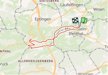
Randonnée Autre activité de 12,7 km à découvrir à Soleure, Bezirk Gösgen, Hauenstein-Ifenthal. Cette randonnée est proposée par hrb.
Description
Ev. besser Start in Le Signal
Châlet dernier im Sommer eine Beiz
Localisation
Pays :
Suisse
Région :
Soleure
Département/Province :
Bezirk Gösgen
Commune :
Hauenstein-Ifenthal
Localité :
Unknown
Départ:(Dec)
Départ:(UTM)
414259 ; 5247826 (32T) N.
Commentaires