


2020-06-05 - 07. Le Garn. La Châtaigneraie

dansmabulle
Utilisateur
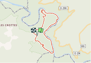

Longueur
7,9 km

Altitude max
273 m

Dénivelé positif
383 m
Km-Effort
13 km

Altitude min
62 m

Dénivelé négatif
383 m
Boucle
Oui
Date de création :
2020-06-05 19:33:15.839
Dernière modification :
2020-06-08 20:37:19.63
2h39
Difficulté : Moyen

Application GPS de randonnée GRATUITE
 SityTrail
IGN / Instituts géographiques
SityTrail Plus
Le monde est à vous
À propos
Randonnée Marche de 7,9 km à découvrir à Auvergne-Rhône-Alpes, Ardèche, Labastide-de-Virac. Cette randonnée est proposée par dansmabulle.
Localisation
Pays :
France
Région :
Auvergne-Rhône-Alpes
Département/Province :
Ardèche
Commune :
Labastide-de-Virac
Localité :
Unknown
Départ:(Dec)
Départ:(UTM)
615822 ; 4911881 (31T) N.
Commentaires