Randonnée Marche Authon - Rando765 - Photo
 Escondido
Escondido

Utilisateur

© OpenStreetMap contributors
Longueur
Longueur
21 km
Boucle
Boucle
Oui
Date de création :
2020-06-17 08:24:33.154
Dernière modification :
2020-06-18 13:35:33.369

(0 Avis)

Marche
Marche
5h04
Difficulté : Difficile

Scannez ce code QR pour ouvrir la randonnée dans l'application SityTrail

Application GPS de randonnée GRATUITE

Logo SityTrail SityTrail

IGN / Instituts géographiques

Télécharger SityTrail sur l'App Store Télécharger SityTrail sur Google Play

Logo SityTrail SityTrail World

Le monde est à vous

Télécharger SityTrail sur l'App Store Télécharger SityTrail sur Google Play Télécharger SityTrail sur Huawei AppGallery

À propos

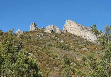
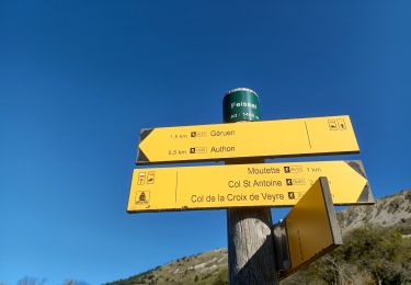
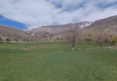
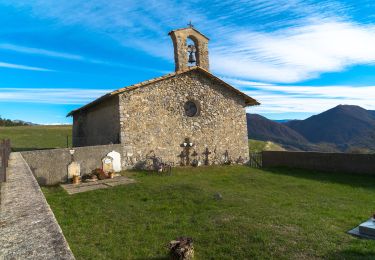
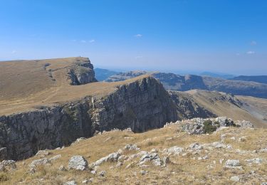
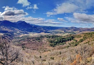
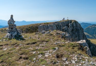
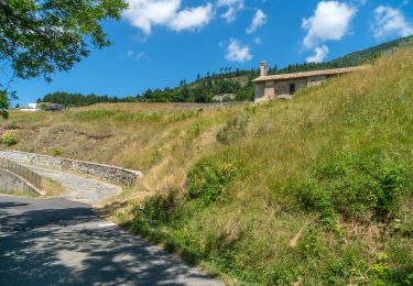
Randonnée Marche de 21 km à découvrir à Provence-Alpes-Côte d'Azur, Alpes-de-Haute-Provence, Authon. Cette randonnée est proposée par Escondido.

Description

les Monges Prabalayre

Profil altimétrique

Localisation

Pays :
France
Région :
Provence-Alpes-Côte d'Azur
Département/Province :
Alpes-de-Haute-Provence
Commune :
Authon
Localité :
Unknown
Départ:(UTM)
270732 ; 4902255 (32T) N.

Randonnées à proximité

Randonnée Marche Authon - 20180912_Monges_Authon_Boucle_Sommet Coste belle - Photo
Marche
PapouBertrand

Marche

Difficile
(1)
Authon, Provence-Alpes-Côte d'Azur, Alpes-de-Haute-Provence, France
15,2 km | 28 km-effort
5h 35min
Oui
Randonnée Marche Saint-Geniez - 28-10-2022 Tour du Dromon - Photo
Marche
GUIDE
Kargil

Marche

Facile
Saint-Geniez, Provence-Alpes-Côte d'Azur, Alpes-de-Haute-Provence, France
12,8 km | 19,7 km-effort
4h 12min
Oui
Randonnée Marche Authon - AUTHON . FAISSAL .LES MONGES . LA CROIX DE VEYRE O L M  - Photo
Marche
RobinMicheline

Marche

Très difficile
Authon, Provence-Alpes-Côte d'Azur, Alpes-de-Haute-Provence, France
14,3 km | 25 km-effort
4h 47min
Oui
Randonnée Marche Authon - AUTHON . COL DE LA SAPIE .CRETE DU CLOT DES MARTHES . CABAN DE CHINE N - Photo
Marche
RobinMicheline

Marche

Difficile
Authon, Provence-Alpes-Côte d'Azur, Alpes-de-Haute-Provence, France
13,6 km | 22 km-effort
4h 15min
Oui
Randonnée Marche Le Castellard-Mélan - Mélan Parua Taulisson Le Cognet Col de Mounis Mélan - Photo
Marche
jalien04

Marche

Moyen
Le Castellard-Mélan, Provence-Alpes-Côte d'Azur, Alpes-de-Haute-Provence, France
7 km | 10 km-effort
1h 57min
Oui
Randonnée A pied Authon - Les Monges - Photo
A pied
Marco05

A pied

Difficile
Authon, Provence-Alpes-Côte d'Azur, Alpes-de-Haute-Provence, France
14,2 km | 27 km-effort
6h 2min
Oui
Randonnée Marche Le Castellard-Mélan - Sentier des Brigants - Photo
Marche
PapouBertrand

Marche

Très difficile
Le Castellard-Mélan, Provence-Alpes-Côte d'Azur, Alpes-de-Haute-Provence, France
15,6 km | 24 km-effort
5h 4min
Oui
Randonnée Marche Authon - Sommet des Monges - Photo
Marche
jalien04

Marche

Difficile
Authon, Provence-Alpes-Côte d'Azur, Alpes-de-Haute-Provence, France
14,7 km | 27 km-effort
7h 26min
Oui
Randonnée Marche Le Castellard-Mélan - Auribeau depuis Melan - Photo
Marche
jalien04

Marche

Moyen
Le Castellard-Mélan, Provence-Alpes-Côte d'Azur, Alpes-de-Haute-Provence, France
11,1 km | 16,7 km-effort
3h 48min
Oui


Fermer
Mes abonnements