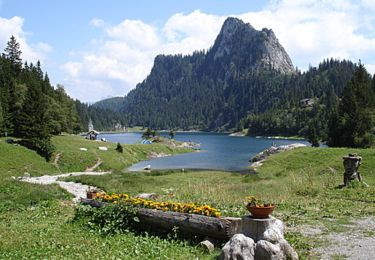
Randonnée V.T.T. Saint-Gingolph - WallisBike 01 St-Gingolph - Morgins - Photo

WallisBike 01 St-Gingolph - Morgins

 ovronne
ovronne

Utilisateur

© OpenStreetMap contributors
Longueur
Longueur
38 km
Altitude max
Altitude max
1863 m
Dénivelé positif
Dénivelé positif
2659 m
Km-Effort
Km-Effort  
70 km
Altitude min
Altitude min
397 m
Dénivelé négatif
Dénivelé négatif
1707 m
Boucle
Boucle
Non
Date de création :
2014-12-11 00:00:00.0
Dernière modification :
2014-12-11 00:00:00.0

(0 Avis)

V.T.T.
V.T.T.
7h00
Difficulté : Inconnu

Scannez ce code QR pour ouvrir la randonnée dans l'application SityTrail

Application GPS de randonnée GRATUITE

Logo SityTrail SityTrail

IGN / Instituts géographiques

Télécharger SityTrail sur l'App Store Télécharger SityTrail sur Google Play

Logo SityTrail SityTrail World

Le monde est à vous

Télécharger SityTrail sur l'App Store Télécharger SityTrail sur Google Play Télécharger SityTrail sur Huawei AppGallery

À propos

Randonnée V.T.T. de 38 km à découvrir à Valais, Monthey, Saint-Gingolph. Cette randonnée est proposée par ovronne.

Description

Première étape de la traversée des Alpes Suisse de St-Gingolph à Scuol.

De St-Gingolph montée en direction du Col de la Croix puis du Pas de Lovenex.
Descente sur le Lac de Taney, passage du Col de Taney et direction Torgon.
Montée vers les Portes de Culet et descente sur le point d''arrivée Morgins.

Profil altimétrique

Localisation

Pays :
Suisse
Région :
Valais
Département/Province :
Monthey
Commune :
Saint-Gingolph
Localité :
Unknown
Départ:(Dec)
Départ:(UTM)
331327 ; 5139932 (32T) N.

Randonnées à proximité

Randonnée V.T.T. Saint-Gingolph - TransAlpes VTT - 01/25 - St Gingolf - Lac de Tanay - Photo
V.T.T.
tracegps

V.T.T.

Difficile
Saint-Gingolph, Valais, Monthey, Suisse
13,8 km | 27 km-effort
2h 30min
Non
Randonnée Marche Thollon-les-Mémises - 15 juillet - Photo
Marche
Huangdi

Marche

Très facile
Thollon-les-Mémises, Auvergne-Rhône-Alpes, Haute-Savoie, France
10,8 km | 26 km-effort
4h 27min
Non
Randonnée Autre activité Saint-Gingolph - bdx001_0623 - Photo
Autre activité
GUIDE+

Autre activité

Très facile
Saint-Gingolph, Valais, Monthey, Suisse
11,3 km | 35 km-effort
8h 5min
Non
Randonnée Autre activité Saint-Gingolph - ST_harlin_test - Photo
Autre activité
GUIDE+

Autre activité

Très facile
Saint-Gingolph, Auvergne-Rhône-Alpes, Haute-Savoie, France
32 km | 84 km-effort
14h 44min
Non
Randonnée Autre activité Le Léman (VS) - bdr99_StGingolphe_Leysin - Photo
Autre activité
GUIDE+

Autre activité

Très facile
Le Léman (VS), Valais, Monthey, Suisse
26 km | 38 km-effort
8h 59min
Non
Randonnée Autre activité Le Léman (VS) - bdr01_StGingolphe_Trient - Photo
Autre activité
GUIDE+

Autre activité

Très facile
Le Léman (VS), Valais, Monthey, Suisse
68 km | 170 km-effort
40h 54min
Non
Randonnée Autre activité Saint-Gingolph - xxx20_Heremence_StGingolphe - Photo
Autre activité
GUIDE+

Autre activité

Très facile
Saint-Gingolph, Valais, Monthey, Suisse
59 km | 59 km-effort
13h 24min
Non
Randonnée Marche Novel - Novel -Col de Neuva et Pic Boré - Photo
Marche
marcel.F

Marche

Très difficile
Novel, Auvergne-Rhône-Alpes, Haute-Savoie, France
10,3 km | 20 km-effort
4h 37min
Oui
Randonnée sport Saint-Gingolph - Etape1 St Gingolph-Refuge Chalets de Bise - Photo
sport
anne.legrand

sport

Très facile
Saint-Gingolph, Valais, Monthey, Suisse
11,2 km | 28 km-effort
Inconnu
Non


Fermer
Mes abonnements