Randonnée Marche Arnaud-Guilhem - Arnaud-Guilhem - Sentier des Légendes  - Photo

Arnaud-Guilhem - Sentier des Légendes

 olivicol
olivicol

Utilisateur

© OpenStreetMap contributors
Longueur
Longueur
6,6 km
Altitude max
Altitude max
423 m
Dénivelé positif
Dénivelé positif
150 m
Km-Effort
Km-Effort  
8,6 km
Altitude min
Altitude min
312 m
Dénivelé négatif
Dénivelé négatif
148 m
Boucle
Boucle
Oui
Date de création :
2020-07-21 07:17:19.65
Dernière modification :
2022-04-04 15:45:13.208

(0 Avis)

Marche
Marche
1h29
Difficulté : Très facile

Scannez ce code QR pour ouvrir la randonnée dans l'application SityTrail

Application GPS de randonnée GRATUITE

Logo SityTrail SityTrail

IGN / Instituts géographiques

Télécharger SityTrail sur l'App Store Télécharger SityTrail sur Google Play

Logo SityTrail SityTrail World

Le monde est à vous

Télécharger SityTrail sur l'App Store Télécharger SityTrail sur Google Play Télécharger SityTrail sur Huawei AppGallery

À propos

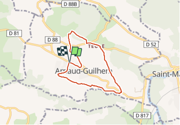
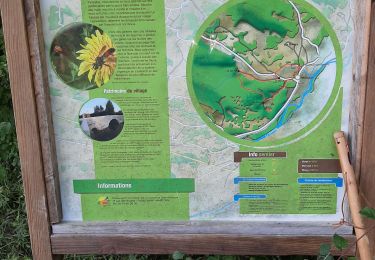
Randonnée Marche de 6,6 km à découvrir à Occitanie, Haute-Garonne, Arnaud-Guilhem. Cette randonnée est proposée par olivicol.

Description

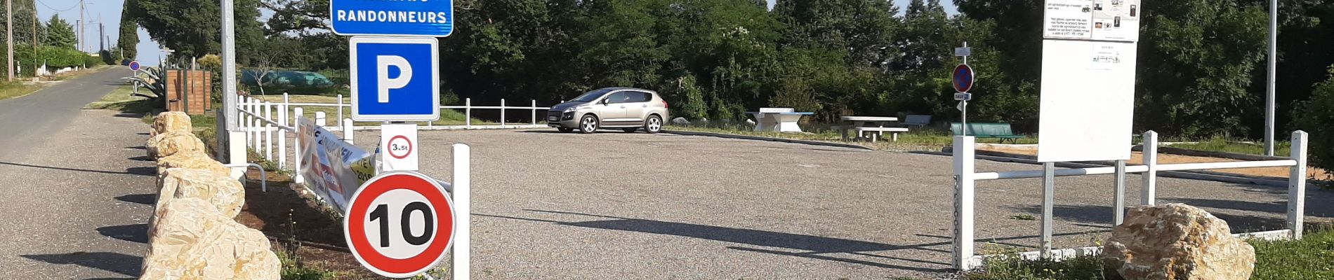
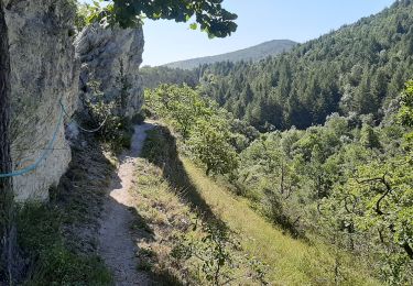
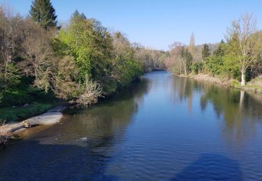
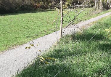
Sentier de 6,60 km. Départ Aire des randonneurs à Arnaud-Guilhem. Vue sur la chaîne des Pyrénées, passage près de 3 lavoirs. Marche facile.

Profil altimétrique

Photos

Localisation

Pays :
France
Région :
Occitanie
Département/Province :
Haute-Garonne
Commune :
Arnaud-Guilhem
Localité :
Unknown
Départ:(UTM)
328724 ; 4778992 (31T) N.

Randonnées à proximité

Randonnée Marche Laffite-Toupière - Sentier des Crêtes - Auderette  - Photo
Marche
olivicol

Marche

Très facile
Laffite-Toupière, Occitanie, Haute-Garonne, France
5,2 km | 7,3 km-effort
1h 31min
Oui
Randonnée Marche Saint-Martory - Via Garona 2 St Martory Labarthe Inard - Photo
Marche
neleda

Marche

Très facile
Saint-Martory, Occitanie, Haute-Garonne, France
19,4 km | 25 km-effort
6h 55min
Non
Randonnée V.T.C. Salies-du-Salat - lacave - Photo
V.T.C.
kayamambo

V.T.C.

Facile
Salies-du-Salat, Occitanie, Haute-Garonne, France
18,8 km | 20 km-effort
1h 14min
Oui
Randonnée Marche Laffite-Toupière - Lafite toupière court fait 2022 - Photo
Marche
pidjam

Marche

Facile
Laffite-Toupière, Occitanie, Haute-Garonne, France
5,1 km | 6,9 km-effort
1h 47min
Oui
Randonnée Marche Arnaud-Guilhem - Le Lances  - Photo
Marche
olivicol

Marche

Très facile
Arnaud-Guilhem, Occitanie, Haute-Garonne, France
2,2 km | 3,1 km-effort
48min
Non
Randonnée Marche Laffite-Toupière - Laffite Mancioux la Noue  - Photo
Marche
olivicol

Marche

Très facile
Laffite-Toupière, Occitanie, Haute-Garonne, France
4,3 km | 5 km-effort
1h 2min
Oui
Randonnée Marche Saint-Martory - 31_Saint Martory - Photo
Marche
jab31

Marche

Moyen
Saint-Martory, Occitanie, Haute-Garonne, France
14,7 km | 22 km-effort
3h 58min
Oui
Randonnée V.T.T. Auzas - Cazeneuve  Aulon - Photo
V.T.T.
tracegps

V.T.T.

Moyen
Auzas, Occitanie, Haute-Garonne, France
16,6 km | 22 km-effort
1h 30min
Oui
Randonnée Marche Auzas - Cazeneuve  Aulon - Photo
Marche
tracegps

Marche

Difficile
Auzas, Occitanie, Haute-Garonne, France
16,6 km | 22 km-effort
4h 0min
Oui


Fermer
Mes abonnements