Randonnée Marche Saint-Jean-Lespinasse - La Causse de Lauriol - Photo
 richardsimopons
richardsimopons

Utilisateur

© OpenStreetMap contributors
Longueur
Longueur
10,6 km
Altitude max
Altitude max
362 m
Dénivelé positif
Dénivelé positif
271 m
Km-Effort
Km-Effort  
14,2 km
Altitude min
Altitude min
146 m
Dénivelé négatif
Dénivelé négatif
269 m
Boucle
Boucle
Oui
Date de création :
2020-07-22 06:53:52.0
Dernière modification :
2020-07-22 10:20:22.842

(0 Avis)

Marche
Marche
3h06
Difficulté : Inconnu

Scannez ce code QR pour ouvrir la randonnée dans l'application SityTrail

Application GPS de randonnée GRATUITE

Logo SityTrail SityTrail

IGN / Instituts géographiques

Télécharger SityTrail sur l'App Store Télécharger SityTrail sur Google Play

Logo SityTrail SityTrail World

Le monde est à vous

Télécharger SityTrail sur l'App Store Télécharger SityTrail sur Google Play Télécharger SityTrail sur Huawei AppGallery

À propos

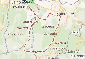
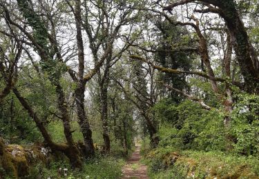
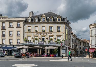
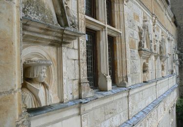
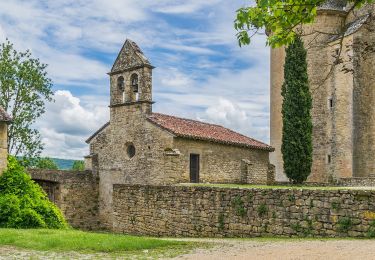
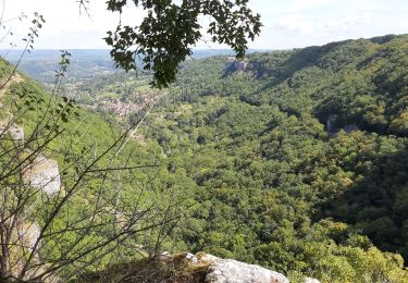
Randonnée Marche de 10,6 km à découvrir à Occitanie, Lot, Saint-Jean-Lespinasse. Cette randonnée est proposée par richardsimopons.

Description

A partir de l’Hotel les 3 soleils de Montal , la colline (la Croix) le Causse, le Segala (forêts) en boucle : très belle randonnée, 3 h, 10.6 km, 250m.

Profil altimétrique

Photos

Localisation

Pays :
France
Région :
Occitanie
Département/Province :
Lot
Commune :
Saint-Jean-Lespinasse
Localité :
Unknown
Départ:(Dec)
Départ:(UTM)
410360 ; 4968331 (31T) N.

Randonnées à proximité

Randonnée Marche Loubressac - Nos plus beaux villages - Photo
Marche
alain2306

Marche

Difficile
(1)
Loubressac, Occitanie, Lot, France
9,9 km | 14,2 km-effort
3h 0min
Oui
Randonnée Marche Prudhomat - autour de castelnau - Photo
Marche
lefrancm

Marche

Très facile
(1)
Prudhomat, Occitanie, Lot, France
3,5 km | 4,8 km-effort
1h 48min
Non
Randonnée Marche Loubressac - Loubressac-Château des Anglais - Photo
Marche
werth

Marche

Facile
Loubressac, Occitanie, Lot, France
8,6 km | 12,1 km-effort
2h 21min
Oui
Randonnée A pied Saint-Céré - Randonnées au Pays du Saint-Céré - Photo
A pied
PRO

A pied

Facile
Saint-Céré, Occitanie, Lot, France
13,3 km | 19,3 km-effort
4h 23min
Non
Randonnée A pied Saint-Jean-Lespinasse - St Jean Lespinasse - La Césarine - Photo
A pied
PRO

A pied

Facile
Saint-Jean-Lespinasse, Occitanie, Lot, France
3,8 km | 5,9 km-effort
1h 20min
Oui
Randonnée A pied Saint-Céré - St Céré - Les tours de St Laurent - Photo
A pied
PRO

A pied

Facile
Saint-Céré, Occitanie, Lot, France
4,9 km | 7,8 km-effort
1h 45min
Oui
Randonnée A pied Saint-Céré - St Céré - Le Causse de Lauriol - Photo
A pied
PRO

A pied

Facile
Saint-Céré, Occitanie, Lot, France
9,1 km | 12,3 km-effort
2h 47min
Oui
Randonnée A pied Saint-Céré - St Céré - De Pommiers à Tourel - Photo
A pied
PRO

A pied

Facile
Saint-Céré, Occitanie, Lot, France
7,8 km | 11 km-effort
2h 30min
Oui
Randonnée Marche Loubressac - autoire cascade siran - Photo
Marche
Forsans

Marche

Moyen
Loubressac, Occitanie, Lot, France
5,5 km | 8,4 km-effort
1h 55min
Non


Fermer
Mes abonnements