Randonnée Randonnée équestre Saint-Germain-les-Paroisses - repérage st germain inimond cheval - Photo

repérage st germain inimond cheval

 Nolene
Nolene

Utilisateur

© OpenStreetMap contributors
Longueur
Longueur
14,6 km
Altitude max
Altitude max
906 m
Dénivelé positif
Dénivelé positif
458 m
Km-Effort
Km-Effort  
21 km
Altitude min
Altitude min
360 m
Dénivelé négatif
Dénivelé négatif
625 m
Boucle
Boucle
Non
Date de création :
2020-08-02 09:39:03.923
Dernière modification :
2020-08-02 15:28:00.941

(1 Avis)

Randonnée équestre
Randonnée équestre
5h07
Difficulté : Moyen

Scannez ce code QR pour ouvrir la randonnée dans l'application SityTrail

Application GPS de randonnée GRATUITE

Logo SityTrail SityTrail

IGN / Instituts géographiques

Télécharger SityTrail sur l'App Store Télécharger SityTrail sur Google Play

Logo SityTrail SityTrail World

Le monde est à vous

Télécharger SityTrail sur l'App Store Télécharger SityTrail sur Google Play Télécharger SityTrail sur Huawei AppGallery

À propos

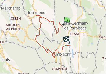
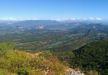
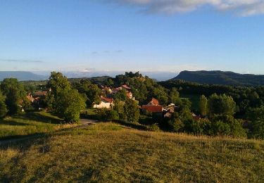
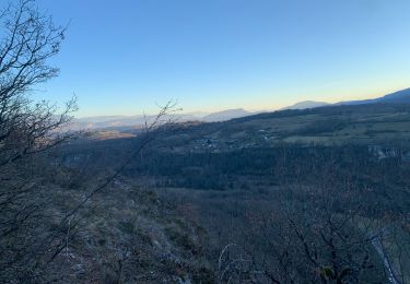
Randonnée Randonnée équestre de 14,6 km à découvrir à Auvergne-Rhône-Alpes, Ain, Saint-Germain-les-Paroisses. Cette randonnée est proposée par Nolene.

Profil altimétrique

Photos

Localisation

Pays :
France
Région :
Auvergne-Rhône-Alpes
Département/Province :
Ain
Commune :
Saint-Germain-les-Paroisses
Localité :
Unknown
Départ:(UTM)
702414 ; 5071996 (31T) N.

Commentaires

Veuillez vous connecter pour laisser un commentaire ou une note


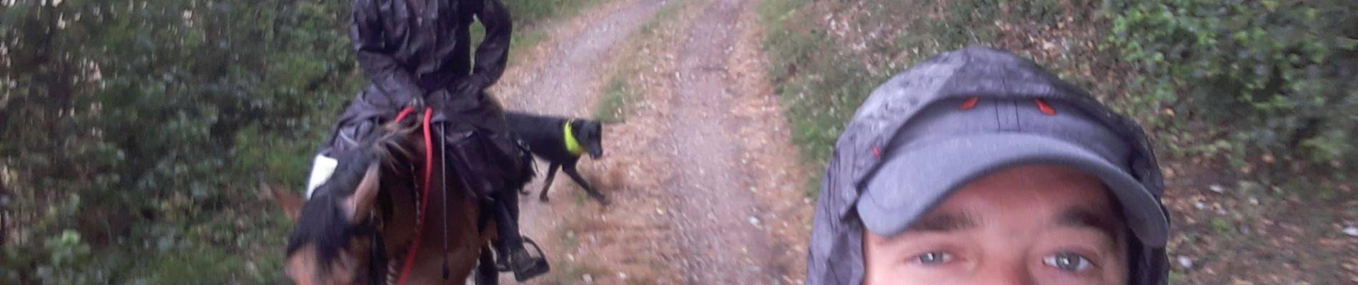
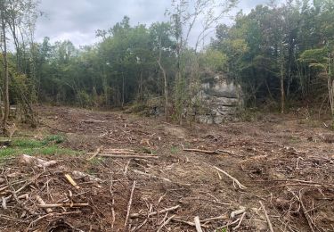
tres jolie balade avec quelques passages légèrement compliqué par ma végétation !


Randonnées à proximité

Randonnée Marche Marchamp - La cascade de la Brive, Cerin et Marchamp - Photo
Marche
tracegps

Marche

Facile
(2)
Marchamp, Auvergne-Rhône-Alpes, Ain, France
8,2 km | 13,8 km-effort
3h 0min
Oui
Randonnée V.T.T. Andert-et-Condon - Boucle sous Gevrin  - Photo
V.T.T.
sandrine-s01

V.T.T.

Facile
(1)
Andert-et-Condon, Auvergne-Rhône-Alpes, Ain, France
13,1 km | 17,1 km-effort
1h 1min
Oui
Randonnée V.T.T. Innimond - tentanet la graye - Photo
V.T.T.
malc

V.T.T.

Très difficile
Innimond, Auvergne-Rhône-Alpes, Ain, France
48 km | 75 km-effort
3h 50min
Oui
Randonnée V.T.T. Innimond - innimond-Mollard de don - Photo
V.T.T.
malc

V.T.T.

Moyen
(2)
Innimond, Auvergne-Rhône-Alpes, Ain, France
24 km | 33 km-effort
2h 15min
Oui
Randonnée Marche Innimond - Le tour du Fays avec le mollard Rond - Photo
Marche
malc

Marche

Facile
Innimond, Auvergne-Rhône-Alpes, Ain, France
7,8 km | 9,4 km-effort
2h 0min
Oui
Randonnée V.T.T. Saint-Germain-les-Paroisses - 6-5-15 - Photo
V.T.T.
jeannot01

V.T.T.

Très facile
(1)
Saint-Germain-les-Paroisses, Auvergne-Rhône-Alpes, Ain, France
25 km | 37 km-effort
2h 57min
Oui
Randonnée V.T.T. Innimond - innimond lompnaz - Photo
V.T.T.
malc

V.T.T.

Moyen
Innimond, Auvergne-Rhône-Alpes, Ain, France
16,4 km | 24 km-effort
1h 36min
Non
Randonnée V.T.T. Andert-et-Condon - Recherche suite chemin du dimanche vers Gramont - Photo
V.T.T.
sandrine-s01

V.T.T.

Très difficile
Andert-et-Condon, Auvergne-Rhône-Alpes, Ain, France
11,6 km | 16,6 km-effort
1h 7min
Oui
Randonnée V.T.T. Andert-et-Condon - Sous Gevrin et Veript - Photo
V.T.T.
sandrine-s01

V.T.T.

Moyen
Andert-et-Condon, Auvergne-Rhône-Alpes, Ain, France
16,7 km | 22 km-effort
1h 28min
Non


Fermer
Mes abonnements