Randonnée Marche Saint-Héand - St Heand, Montrond, Mont Morin, Pierre de la Bauche et retour St Heand - Photo

St Heand, Montrond, Mont Morin, Pierre de la Bauche et retour St Heand

 acsglaurent
acsglaurent

Utilisateur

© OpenStreetMap contributors
Longueur
Longueur
16 km
Altitude max
Altitude max
864 m
Dénivelé positif
Dénivelé positif
537 m
Km-Effort
Km-Effort  
23 km
Altitude min
Altitude min
540 m
Dénivelé négatif
Dénivelé négatif
537 m
Boucle
Boucle
Oui
Date de création :
2014-12-10 00:00:00.0
Dernière modification :
2014-12-10 00:00:00.0

(1 Avis)

Marche
Marche
5h20
Difficulté : Moyen

Scannez ce code QR pour ouvrir la randonnée dans l'application SityTrail

Application GPS de randonnée GRATUITE

Logo SityTrail SityTrail

IGN / Instituts géographiques

Télécharger SityTrail sur l'App Store Télécharger SityTrail sur Google Play

Logo SityTrail SityTrail World

Le monde est à vous

Télécharger SityTrail sur l'App Store Télécharger SityTrail sur Google Play Télécharger SityTrail sur Huawei AppGallery

À propos

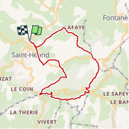
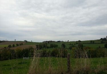
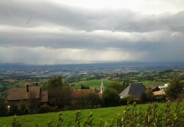
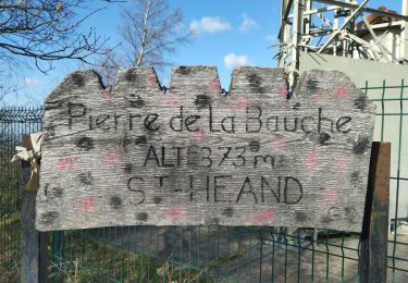
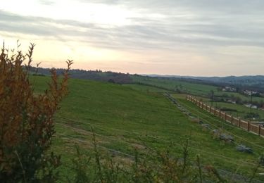
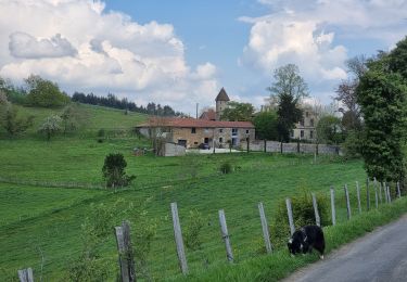
Randonnée Marche de 16 km à découvrir à Auvergne-Rhône-Alpes, Loire, Saint-Héand. Cette randonnée est proposée par acsglaurent.

Description

ne pas tenir compte du temps

Profil altimétrique

Localisation

Pays :
France
Région :
Auvergne-Rhône-Alpes
Département/Province :
Loire
Commune :
Saint-Héand
Localité :
Unknown
Départ:(Dec)
Départ:(UTM)
607582 ; 5043351 (31T) N.

Commentaires

Veuillez vous connecter pour laisser un commentaire ou une note


Randonnées à proximité

Randonnée Marche Sorbiers - sorbiers 23/2 - Photo
Marche
stefp42

Marche

Difficile
(1)
Sorbiers, Auvergne-Rhône-Alpes, Loire, France
23 km | 35 km-effort
4h 36min
Oui
Randonnée Marche Sorbiers - sorbiers - Photo
Marche
stefp42

Marche

Difficile
(1)
Sorbiers, Auvergne-Rhône-Alpes, Loire, France
23 km | 36 km-effort
4h 46min
Oui
Randonnée Marche Sorbiers - sorbiers-st christo - valfeury  - Photo
Marche
stefp42

Marche

Moyen
(1)
Sorbiers, Auvergne-Rhône-Alpes, Loire, France
23 km | 35 km-effort
4h 32min
Oui
Randonnée Marche Saint-Héand - izzy - Photo
Marche
bena42

Marche

Facile
Saint-Héand, Auvergne-Rhône-Alpes, Loire, France
5,9 km | 8,1 km-effort
1h 10min
Oui
Randonnée Marche Saint-Héand - tour de st heand - Photo
Marche
acsglaurent

Marche

Très facile
Saint-Héand, Auvergne-Rhône-Alpes, Loire, France
13,2 km | 18,3 km-effort
3h 15min
Oui
Randonnée Marche Saint-Héand - Saint-héand, la pierre de la bauche, les alisiers, le rivollier, les baraques, Saint-héand - Photo
Marche
nollac

Marche

Moyen
Saint-Héand, Auvergne-Rhône-Alpes, Loire, France
12,3 km | 17,8 km-effort
2h 53min
Oui
Randonnée Marche Saint-Bonnet-les-Oules - Saint-Bonnet-les-Oules du 26-12-2022 - Photo
Marche
VANDERPUTTENMi

Marche

Difficile
Saint-Bonnet-les-Oules, Auvergne-Rhône-Alpes, Loire, France
10,8 km | 14,5 km-effort
2h 17min
Oui
Randonnée V.T.T. Fontanès - la fouillouse antenne Aveizieux  - Photo
V.T.T.
bena42

V.T.T.

Difficile
Fontanès, Auvergne-Rhône-Alpes, Loire, France
11,3 km | 14,3 km-effort
4h 9min
Non
Randonnée Marche Aveizieux - Avezieux - Photo
Marche
galain

Marche

Moyen
Aveizieux, Auvergne-Rhône-Alpes, Loire, France
16,3 km | 22 km-effort
3h 47min
Oui


Fermer
Mes abonnements