


BELBRIETTE

surceneux
Utilisateur
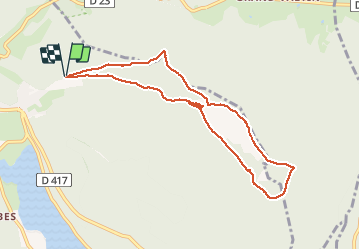

Longueur
8,4 km

Altitude max
925 m

Dénivelé positif
228 m
Km-Effort
11,5 km

Altitude min
812 m

Dénivelé négatif
234 m
Boucle
Oui
Date de création :
2020-09-02 14:08:30.154
Dernière modification :
2020-09-02 21:36:23.189
2h10
Difficulté : Facile

Application GPS de randonnée GRATUITE
 SityTrail
IGN / Instituts géographiques
SityTrail Plus
Le monde est à vous
À propos
Randonnée Marche de 8,4 km à découvrir à Grand Est, Vosges, Xonrupt-Longemer. Cette randonnée est proposée par surceneux.
Description
BELBRIETTE TOUR PAR VALLON ET DETOURS..
Localisation
Pays :
France
Région :
Grand Est
Département/Province :
Vosges
Commune :
Xonrupt-Longemer
Localité :
Unknown
Départ:(Dec)
Départ:(UTM)
347706 ; 5327989 (32U) N.
Commentaires