Randonnée Marche Saint-Sernin-du-Plain - Mazenay les deux monts page 17 - Photo
 grasgilbert
grasgilbert

Utilisateur

© OpenStreetMap contributors
Longueur
Longueur
13,5 km
Altitude max
Altitude max
542 m
Dénivelé positif
Dénivelé positif
442 m
Km-Effort
Km-Effort  
19,4 km
Altitude min
Altitude min
276 m
Dénivelé négatif
Dénivelé négatif
440 m
Boucle
Boucle
Oui
Date de création :
2020-10-08 11:46:35.857
Dernière modification :
2023-10-12 18:15:44.572

(1 Avis)

Marche
Marche
4h24
Difficulté : Très difficile

Scannez ce code QR pour ouvrir la randonnée dans l'application SityTrail

Application GPS de randonnée GRATUITE

Logo SityTrail SityTrail

IGN / Instituts géographiques

Télécharger SityTrail sur l'App Store Télécharger SityTrail sur Google Play

Logo SityTrail SityTrail World

Le monde est à vous

Télécharger SityTrail sur l'App Store Télécharger SityTrail sur Google Play Télécharger SityTrail sur Huawei AppGallery

À propos

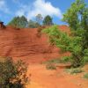
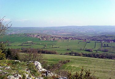
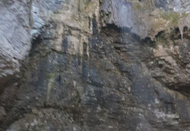
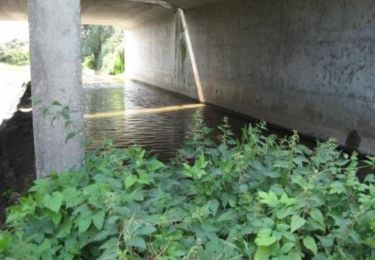
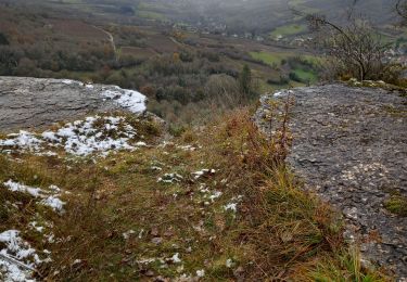
Randonnée Marche de 13,5 km à découvrir à Bourgogne-Franche-Comté, Saône-et-Loire, Saint-Sernin-du-Plain. Cette randonnée est proposée par grasgilbert.

Description

superbe randonnée pour randonneurs averti

Profil altimétrique

Localisation

Pays :
France
Région :
Bourgogne-Franche-Comté
Département/Province :
Saône-et-Loire
Commune :
Saint-Sernin-du-Plain
Localité :
Unknown
Départ:(UTM)
621524 ; 5196176 (31T) N.

Commentaires

Veuillez vous connecter pour laisser un commentaire ou une note


Randonnées à proximité

Randonnée Marche Nolay - Circuit Jean-Marc Boivin - Nolay - Photo
Marche
tracegps

Marche

Très difficile
(2)
Nolay, Bourgogne-Franche-Comté, Côte-d'Or, France
47 km | 67 km-effort
10h 0min
Oui
Randonnée Marche Saint-Maurice-lès-Couches - Saint Maurice les Couches  GRS (gde) - Photo
Marche
Malice0093

Marche

Difficile
(1)
Saint-Maurice-lès-Couches, Bourgogne-Franche-Comté, Saône-et-Loire, France
11,5 km | 15,3 km-effort
3h 29min
Oui
Randonnée Marche Sampigny-lès-Maranges - Sampigny les maranges les balcons de la Cozanne page 123 - Photo
Marche
grasgilbert

Marche

Difficile
(4)
Sampigny-lès-Maranges, Bourgogne-Franche-Comté, Saône-et-Loire, France
12,6 km | 17 km-effort
3h 51min
Oui
Randonnée Marche Nolay - Nolay - Photo
Marche
pensionisten71

Marche

Très difficile
Nolay, Bourgogne-Franche-Comté, Côte-d'Or, France
18,6 km | 27 km-effort
4h 34min
Oui
Randonnée Marche Couches - couches saint jean de trézy - Photo
Marche
patourad

Marche

Facile
(1)
Couches, Bourgogne-Franche-Comté, Saône-et-Loire, France
11 km | 14,4 km-effort
3h 3min
Oui
Randonnée V.T.T. Dennevy - Bourges (18) - Breurey lès Faverney (70) - Etape 4/6 - De Dennevy à Echigey - Photo
V.T.T.
tracegps

V.T.T.

Moyen
Dennevy, Bourgogne-Franche-Comté, Saône-et-Loire, France
80 km | 88 km-effort
6h 0min
Non
Randonnée A pied Saint-Gervais-sur-Couches - Le sentier de la Lou - Photo
A pied
PRO

A pied

Facile
Saint-Gervais-sur-Couches, Bourgogne-Franche-Comté, Saône-et-Loire, France
6,3 km | 8,4 km-effort
1h 54min
Non
Randonnée A pied Dracy-lès-Couches - Les Balcons de Dracy - Photo
A pied
PRO

A pied

Facile
Dracy-lès-Couches, Bourgogne-Franche-Comté, Saône-et-Loire, France
7,4 km | 9,2 km-effort
2h 5min
Oui
Randonnée Marche Nolay - JMB boucle Nolay - Photo
Marche
LUCIE2016

Marche

Moyen
Nolay, Bourgogne-Franche-Comté, Côte-d'Or, France
17,3 km | 25 km-effort
4h 14min
Oui


Fermer
Mes abonnements