Randonnée Marche Brennilis - Le Youdig - Photo
 fl29790
fl29790

Utilisateur

© OpenStreetMap contributors
Longueur
Longueur
7,8 km
Altitude max
Altitude max
248 m
Dénivelé positif
Dénivelé positif
62 m
Km-Effort
Km-Effort  
8,6 km
Altitude min
Altitude min
219 m
Dénivelé négatif
Dénivelé négatif
62 m
Boucle
Boucle
Oui
Date de création :
2014-12-10 00:00:00.0
Dernière modification :
2014-12-10 00:00:00.0

(1 Avis)

Marche
Marche
1h56
Difficulté : Facile

Scannez ce code QR pour ouvrir la randonnée dans l'application SityTrail

Application GPS de randonnée GRATUITE

Logo SityTrail SityTrail

IGN / Instituts géographiques

Télécharger SityTrail sur l'App Store Télécharger SityTrail sur Google Play

Logo SityTrail SityTrail World

Le monde est à vous

Télécharger SityTrail sur l'App Store Télécharger SityTrail sur Google Play Télécharger SityTrail sur Huawei AppGallery

À propos

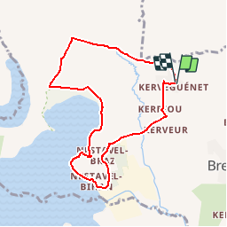
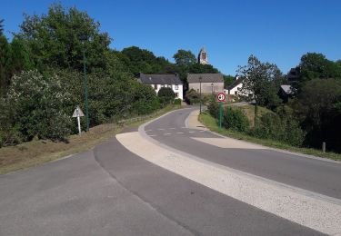
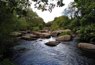
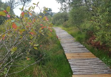
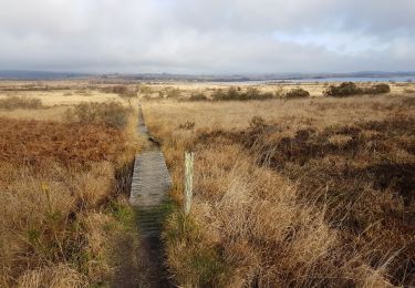
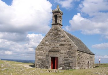
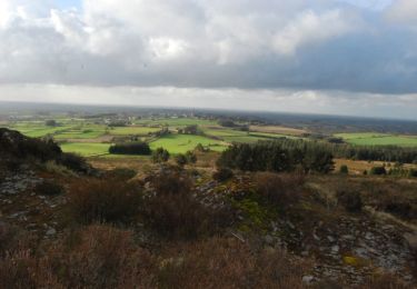
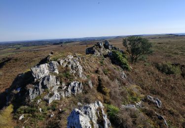
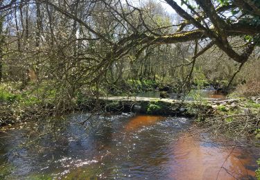
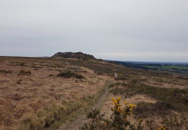
Randonnée Marche de 7,8 km à découvrir à Bretagne, Finistère, Brennilis. Cette randonnée est proposée par fl29790.

Description

Rando facile au départ du Gîte d'étape Le Yougig

Profil altimétrique

Localisation

Pays :
France
Région :
Bretagne
Département/Province :
Finistère
Commune :
Brennilis
Localité :
Unknown
Départ:(Dec)
Départ:(UTM)
436136 ; 5357583 (30U) N.

Commentaires

Veuillez vous connecter pour laisser un commentaire ou une note


Randonnées à proximité

Randonnée A pied Botmeur - Brasparts Circuit des landes et tourbières - Photo
A pied
PRO

A pied

Facile
Botmeur, Bretagne, Finistère, France
3,7 km | 4,2 km-effort
57min
Non
Randonnée Marche Brennilis - BRENNILIS - Photo
Marche
RonanDAGORN

Marche

Moyen
Brennilis, Bretagne, Finistère, France
22 km | 28 km-effort
5h 10min
Oui
Randonnée Marche Brennilis - GR_37_EE_11_Brennilis_St-Rivoal_20200810 - Photo
Marche
patrickdanilo

Marche

Facile
Brennilis, Bretagne, Finistère, France
21 km | 25 km-effort
5h 49min
Non
Randonnée Marche La Feuillée - La Feuillée - Huelgoat - Lac St Michel - Photo
Marche
olibreizh

Marche

Moyen
La Feuillée, Bretagne, Finistère, France
47 km | 56 km-effort
11h 3min
Oui
Randonnée Cheval Loqueffret - Monts d'Arrée et Brennilis - Locqueffret - Photo
Cheval
tracegps

Cheval

Moyen
Loqueffret, Bretagne, Finistère, France
39 km | 48 km-effort
5h 0min
Oui
Randonnée Marche Botmeur - Roc'h Bichourel - Botmeur - Photo
Marche
tracegps

Marche

Moyen
Botmeur, Bretagne, Finistère, France
8,3 km | 10,2 km-effort
2h 30min
Oui
Randonnée Marche La Feuillée - 2023-10-08 Roc'h trévezel - Roc'h ruz  - Photo
Marche
jacq58

Marche

Très facile
La Feuillée, Bretagne, Finistère, France
6,3 km | 7,4 km-effort
1h 33min
Oui
Randonnée Marche Loqueffret - Chaos de Mardoul - Photo
Marche
neleda

Marche

Très facile
Loqueffret, Bretagne, Finistère, France
3,6 km | 4,2 km-effort
1h 3min
Oui
Randonnée Marche La Feuillée - Roc'h 'n Roc'h - Photo
Marche
neleda

Marche

Difficile
La Feuillée, Bretagne, Finistère, France
12,9 km | 15,5 km-effort
3h 14min
Oui


Fermer
Mes abonnements