Randonnée Marche Braine-le-Château - #201214 - Braine-le-Château, Les Monts, Les Fonds et Bruyère Landuyt - Photo

#201214 - Braine-le-Château, Les Monts, Les Fonds et Bruyère Landuyt

 Randos Ouvertes
Randos Ouvertes

Utilisateur

© OpenStreetMap contributors
Longueur
Longueur
7,8 km
Altitude max
Altitude max
127 m
Dénivelé positif
Dénivelé positif
179 m
Km-Effort
Km-Effort  
10,2 km
Altitude min
Altitude min
52 m
Dénivelé négatif
Dénivelé négatif
177 m
Boucle
Boucle
Oui
Date de création :
2020-12-13 14:56:31.521
Dernière modification :
2020-12-17 08:14:52.283

(1 Avis)

Marche
Marche
2h11
Difficulté : Moyen

Scannez ce code QR pour ouvrir la randonnée dans l'application SityTrail

Application GPS de randonnée GRATUITE

Logo SityTrail SityTrail

IGN / Instituts géographiques

Télécharger SityTrail sur l'App Store Télécharger SityTrail sur Google Play

Logo SityTrail SityTrail World

Le monde est à vous

Télécharger SityTrail sur l'App Store Télécharger SityTrail sur Google Play Télécharger SityTrail sur Huawei AppGallery

À propos

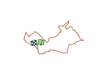
Randonnée Marche de 7,8 km à découvrir à Wallonie, Brabant wallon, Braine-le-Château. Cette randonnée est proposée par Randos Ouvertes.

Description

Point de départ : Place des Martyrs 1 à 1440 Braine-le-Château
Autoévalaution : 2/5
Non revêtu à : 21 pourcents
Nature : 4/5
Eau : 2/5
Trafic : 2/5
Bruit : 3/5 (passages proche du ring)
Urbanisation : 4/5

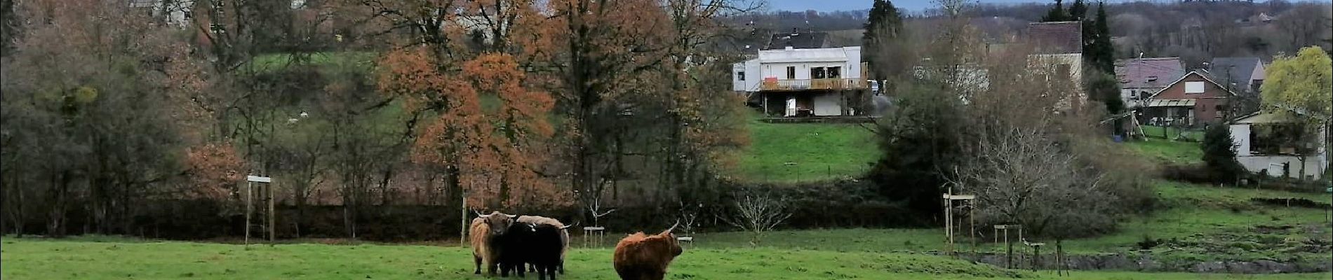
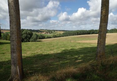
TOP : Patrimoine bâti. Paysages changeants avec perspectives liées au relief accidenté.
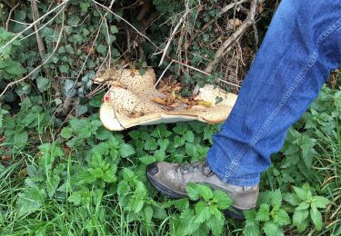
CHECK : Côtes bien raides. Navigation à tourniquets, requiert attention
BOF : Beaucoup de bitume

https://www.sitytrail.com

Profil altimétrique

Photos

Localisation

Pays :
Belgique
Région :
Wallonie
Département/Province :
Brabant wallon
Commune :
Braine-le-Château
Localité :
Braine-le-Château
Départ:(Dec)
Départ:(UTM)
589463 ; 5615261 (31U) N.

Commentaires

Veuillez vous connecter pour laisser un commentaire ou une note


utgyj


Randonnées à proximité

Randonnée Marche Braine-le-Château - RB-Bw-14_Braine-le-Château_via-racc-2 - Photo
Marche
PRO

Marche

Très difficile
(6)
Braine-le-Château, Wallonie, Brabant wallon, Belgique
17,1 km | 22 km-effort
4h 56min
Oui
Randonnée Marche Braine-le-Château - RB-Bw-14_Braine-le-Château - Photo
Marche
PRO

Marche

Très difficile
(7)
Braine-le-Château, Wallonie, Brabant wallon, Belgique
23 km | 29 km-effort
6h 30min
Oui
Randonnée Marche Braine-le-Château - RB-Bw-14_Braine-le-Château_via-racc-1 - Photo
Marche
PRO

Marche

Difficile
(12)
Braine-le-Château, Wallonie, Brabant wallon, Belgique
11,2 km | 14,9 km-effort
3h 22min
Oui
Randonnée Marche Braine-le-Château - Marche Adeps á  Braine-le-Château  - Photo
Marche
GUIDE
Desrumaux

Marche

Très facile
(1)
Braine-le-Château, Wallonie, Brabant wallon, Belgique
10,5 km | 13,7 km-effort
3h 6min
Oui
Randonnée Marche Braine-le-Château - Balade à Braine-le-Château - Photo
Marche
GUIDE
Desrumaux

Marche

Facile
(2)
Braine-le-Château, Wallonie, Brabant wallon, Belgique
10,8 km | 13,7 km-effort
3h 0min
Oui
Randonnée Marche Hal - Balade dans le Bois de Halle - Photo
Marche
GUIDE
Desrumaux

Marche

Facile
(2)
Hal, Flandre, Brabant flamand, Belgique
8,6 km | 10,5 km-effort
2h 14min
Oui
Randonnée Marche Ittre - #230717 - Virginal-Samme, Ardennes et Grand Bois, dont 2,5 km du GRP 127 - Photo
Marche
Randos Ouvertes

Marche

Moyen
(1)
Ittre, Wallonie, Brabant wallon, Belgique
5,1 km | 6,4 km-effort
1h 27min
Oui
Randonnée Marche Ittre - #221031 - Virginal-Samme > Canal, dont 4 km sur GRP127*** - Photo
Marche
Randos Ouvertes

Marche

Moyen
(1)
Ittre, Wallonie, Brabant wallon, Belgique
8,2 km | 9,9 km-effort
2h 15min
Oui
Randonnée Marche Ittre - #200828 - Ittre et golf de la Tournette**** - Photo
Marche
Randos Ouvertes

Marche

Moyen
(1)
Ittre, Wallonie, Brabant wallon, Belgique
7,6 km | 9,2 km-effort
1h 59min
Oui


Fermer
Mes abonnements