Randonnée Marche Maraye-en-Othe - Les Boulins - Photo
 FPortier
FPortier

Utilisateur

© OpenStreetMap contributors
Longueur
Longueur
8,9 km
Altitude max
Altitude max
294 m
Dénivelé positif
Dénivelé positif
138 m
Km-Effort
Km-Effort  
10,8 km
Altitude min
Altitude min
215 m
Dénivelé négatif
Dénivelé négatif
138 m
Boucle
Boucle
Oui
Date de création :
2021-02-09 07:57:58.463
Dernière modification :
2021-02-09 13:38:04.3

(0 Avis)

Marche
Marche
2h21
Difficulté : Facile

Scannez ce code QR pour ouvrir la randonnée dans l'application SityTrail

Application GPS de randonnée GRATUITE

Logo SityTrail SityTrail

IGN / Instituts géographiques

Télécharger SityTrail sur l'App Store Télécharger SityTrail sur Google Play

Logo SityTrail SityTrail World

Le monde est à vous

Télécharger SityTrail sur l'App Store Télécharger SityTrail sur Google Play Télécharger SityTrail sur Huawei AppGallery

À propos

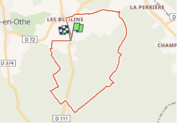
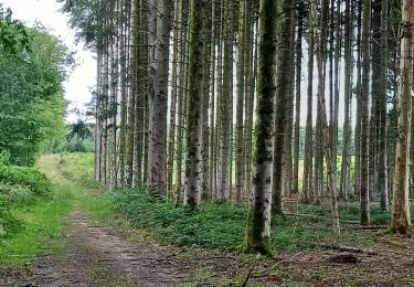
Randonnée Marche de 8,9 km à découvrir à Grand Est, Aube, Maraye-en-Othe. Cette randonnée est proposée par FPortier.

Description

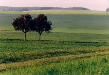
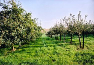
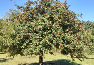
Balade forêt et campagne 3/4 , 1/4

Profil altimétrique

Photos

Localisation

Pays :
France
Région :
Grand Est
Département/Province :
Aube
Commune :
Maraye-en-Othe
Localité :
Unknown
Départ:(UTM)
565187 ; 5334380 (31U) N.

Randonnées à proximité

Randonnée Marche Maraye-en-Othe - Maraye (11+13km) le 21/07/2020 - Photo
Marche
francis1952

Marche

Moyen
Maraye-en-Othe, Grand Est, Aube, France
25 km | 30 km-effort
5h 14min
Oui
Randonnée Marche Eaux-Puiseaux - Circuit des trois Monts - Eaux-Puiseaux - Photo
Marche
tracegps

Marche

Très difficile
Eaux-Puiseaux, Grand Est, Aube, France
14,7 km | 19 km-effort
3h 45min
Oui
Randonnée Marche Maraye-en-Othe - Le circuit des Voirloups - Maraye-en-Othe - Photo
Marche
tracegps

Marche

Très difficile
(1)
Maraye-en-Othe, Grand Est, Aube, France
19,1 km | 24 km-effort
4h 49min
Oui
Randonnée Marche Maraye-en-Othe - Les Vergers de Champcharme - Maraye-en-Othe - Photo
Marche
tracegps

Marche

Difficile
Maraye-en-Othe, Grand Est, Aube, France
14,3 km | 18,6 km-effort
3h 34min
Oui
Randonnée Marche Maraye-en-Othe - Maraye,Nogent,Vosnon,Puiseaux,Chenu,Chamsicourt - Photo
Marche
francis1952

Marche

Difficile
Maraye-en-Othe, Grand Est, Aube, France
31 km | 39 km-effort
6h 11min
Oui
Randonnée Marche Maraye-en-Othe - Maraye 26km le 08.10.2021 - Photo
Marche
francis1952

Marche

Difficile
Maraye-en-Othe, Grand Est, Aube, France
26 km | 32 km-effort
5h 27min
Oui
Randonnée Marche Maraye-en-Othe - Maraye GRBA 11,5km le 05.08.2021 - Photo
Marche
francis1952

Marche

Moyen
Maraye-en-Othe, Grand Est, Aube, France
11,5 km | 14,5 km-effort
2h 44min
Oui
Randonnée Marche Saint-Phal - Chenu Vosnon 33km le 29.07.2021 - Photo
Marche
francis1952

Marche

Difficile
Saint-Phal, Grand Est, Aube, France
34 km | 42 km-effort
6h 34min
Oui
Randonnée Marche Maraye-en-Othe - Marey,Nogent,Vosnon,La Perriere 26km - Photo
Marche
francis1952

Marche

Difficile
Maraye-en-Othe, Grand Est, Aube, France
26 km | 33 km-effort
5h 30min
Oui


Fermer
Mes abonnements