Randonnée Marche Grimaud - HAUTEURS DE BEAUVALLON - Photo
© OpenStreetMap contributors
Longueur
Longueur
6,1 km
Altitude max
Altitude max
348 m
Dénivelé positif
Dénivelé positif
281 m
Km-Effort
Km-Effort  
9,8 km
Altitude min
Altitude min
81 m
Dénivelé négatif
Dénivelé négatif
275 m
Boucle
Boucle
Oui
Date de création :
2021-02-19 13:13:35.203
Dernière modification :
2021-02-19 17:18:10.648

(0 Avis)

Marche
Marche
2h57
Difficulté : Facile

Scannez ce code QR pour ouvrir la randonnée dans l'application SityTrail

Application GPS de randonnée GRATUITE

Logo SityTrail SityTrail

IGN / Instituts géographiques

Télécharger SityTrail sur l'App Store Télécharger SityTrail sur Google Play

Logo SityTrail SityTrail World

Le monde est à vous

Télécharger SityTrail sur l'App Store Télécharger SityTrail sur Google Play Télécharger SityTrail sur Huawei AppGallery

À propos

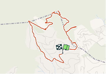
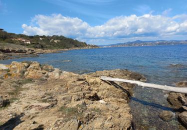
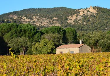
Randonnée Marche de 6,1 km à découvrir à Provence-Alpes-Côte d'Azur, Var, Grimaud. Cette randonnée est proposée par jean-marie.parachini.

Description

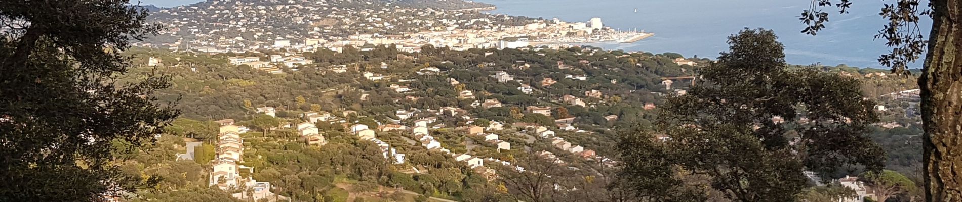
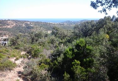
Vues sur golfe de Saint-Tropez et hauteurs de Suane

Profil altimétrique

Photos

Localisation

Pays :
France
Région :
Provence-Alpes-Côte d'Azur
Département/Province :
Var
Commune :
Grimaud
Localité :
Unknown
Départ:(UTM)
305257 ; 4797128 (32T) N.

Randonnées à proximité

Randonnée Marche Saint-Tropez - Saint Tropez  - Photo
Marche
juleyann

Marche

Facile
(1)
Saint-Tropez, Provence-Alpes-Côte d'Azur, Var, France
11,7 km | 13,7 km-effort
4h 19min
Non
Randonnée Marche Sainte-Maxime - la baumette - Photo
Marche
perrucheone

Marche

Facile
(1)
Sainte-Maxime, Provence-Alpes-Côte d'Azur, Var, France
8,1 km | 10,6 km-effort
2h 25min
Oui
Randonnée Marche Saint-Tropez - Golfe de St Tropez - Photo
Marche
tracegps

Marche

Difficile
(2)
Saint-Tropez, Provence-Alpes-Côte d'Azur, Var, France
15,1 km | 17,6 km-effort
4h 30min
Oui
Randonnée Marche Saint-Tropez - St tropez calanque - Photo
Marche
michel1951

Marche

Moyen
(1)
Saint-Tropez, Provence-Alpes-Côte d'Azur, Var, France
9,9 km | 11,4 km-effort
3h 52min
Oui
Randonnée V.T.T. Grimaud - VTT de Port -Grimaud - Photo
V.T.T.
GUIDE
pascalou73

V.T.T.

Moyen
Grimaud, Provence-Alpes-Côte d'Azur, Var, France
21 km | 26 km-effort
1h 45min
Oui
Randonnée V.T.T. Grimaud - VTT du Plan de la Tour - Photo
V.T.T.
GUIDE
pascalou73

V.T.T.

Difficile
(1)
Grimaud, Provence-Alpes-Côte d'Azur, Var, France
35 km | 46 km-effort
2h 59min
Oui
Randonnée V.T.T. Gassin - Patapan - Photo
V.T.T.
trailer.nono

V.T.T.

Moyen
(1)
Gassin, Provence-Alpes-Côte d'Azur, Var, France
37 km | 47 km-effort
2h 24min
Non
Randonnée Marche Saint-Tropez - St Tropez littoral - Photo
Marche
Ninie38MD

Marche

Moyen
Saint-Tropez, Provence-Alpes-Côte d'Azur, Var, France
18,3 km | 22 km-effort
6h 3min
Oui
Randonnée Marche Le Plan-de-la-Tour - Plan de la Tour - Piste de colle Dure - Col de Vignon - Photo
Marche
LtZIP

Marche

Moyen
Le Plan-de-la-Tour, Provence-Alpes-Côte d'Azur, Var, France
18,2 km | 25 km-effort
4h 16min
Oui


Fermer
Mes abonnements