Randonnée Marche Lasserre-de-Prouille - Lasserre de Prouille - Photo
 Jean Marie Pons
Jean Marie Pons

Utilisateur

© OpenStreetMap contributors
Longueur
Longueur
18,2 km
Altitude max
Altitude max
280 m
Dénivelé positif
Dénivelé positif
333 m
Km-Effort
Km-Effort  
23 km
Altitude min
Altitude min
216 m
Dénivelé négatif
Dénivelé négatif
332 m
Boucle
Boucle
Oui
Date de création :
2021-02-25 07:51:32.915
Dernière modification :
2021-02-25 14:21:46.867

(0 Avis)

Marche
Marche
4h23
Difficulté : Très facile

Scannez ce code QR pour ouvrir la randonnée dans l'application SityTrail

Application GPS de randonnée GRATUITE

Logo SityTrail SityTrail

IGN / Instituts géographiques

Télécharger SityTrail sur l'App Store Télécharger SityTrail sur Google Play

Logo SityTrail SityTrail World

Le monde est à vous

Télécharger SityTrail sur l'App Store Télécharger SityTrail sur Google Play Télécharger SityTrail sur Huawei AppGallery

À propos

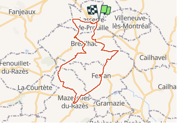
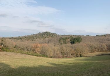
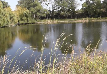
Randonnée Marche de 18,2 km à découvrir à Occitanie, Aude, Lasserre-de-Prouille. Cette randonnée est proposée par Jean Marie Pons.

Profil altimétrique

Localisation

Pays :
France
Région :
Occitanie
Département/Province :
Aude
Commune :
Lasserre-de-Prouille
Localité :
Unknown
Départ:(UTM)
425922 ; 4781244 (31T) N.

Randonnées à proximité

Randonnée Marche Lasserre-de-Prouille - Lasserre de prouilhe 17 kms - Photo
Marche
cappelle

Marche

Moyen
(1)
Lasserre-de-Prouille, Occitanie, Aude, France
16,9 km | 21 km-effort
4h 25min
Oui
Randonnée Marche Fanjeaux - Fanjeaux la hilhe - Photo
Marche
cappelle

Marche

Difficile
(1)
Fanjeaux, Occitanie, Aude, France
9,7 km | 13,2 km-effort
3h 0min
Non
Randonnée V.T.T. Villasavary - circuit 3 villasavary - Photo
V.T.T.
leroj73

V.T.T.

Moyen
(1)
Villasavary, Occitanie, Aude, France
23 km | 30 km-effort
1h 43min
Oui
Randonnée Marche Fanjeaux - Fanjeaux  Boucle de la Hille  - Photo
Marche
Mamilaure

Marche

Moyen
Fanjeaux, Occitanie, Aude, France
13,1 km | 18,3 km-effort
3h 30min
Oui
Randonnée A pied Ferran - À travers Champs et Vignes - Photo
A pied
PRO

A pied

Moyen
Ferran, Occitanie, Aude, France
17,2 km | 21 km-effort
4h 49min
Oui
Randonnée Marche Fanjeaux - Chemin du Piémont Pyrénéen - de Fanjeaux à Mirepoix - Photo
Marche
tracegps

Marche

Difficile
(1)
Fanjeaux, Occitanie, Aude, France
26 km | 33 km-effort
6h 0min
Non
Randonnée Marche Fanjeaux - 2023 09 16 CHEMIN du PIÉMONT PYRÉNÉEN - 9ème étapes :  FANGEAUX - HOUNOUX - MALEGOUDE - MIREPOIX - Photo
Marche
LEGUE

Marche

Difficile
Fanjeaux, Occitanie, Aude, France
25 km | 33 km-effort
4h 51min
Non
Randonnée Marche Villasavary - Villasavary - Photo
Marche
Christophe Ferreres

Marche

Moyen
Villasavary, Occitanie, Aude, France
7,8 km | 10,4 km-effort
3h 3min
Oui
Randonnée Marche Cailhau - papillon cailhau - Photo
Marche
obriet

Marche

Très facile
Cailhau, Occitanie, Aude, France
9,9 km | 12 km-effort
2h 52min
Oui


Fermer
Mes abonnements