Randonnée V.T.T. Morgny-la-Pommeraye - Petit parcours - Photo
 Grégory Letoquart
Grégory Letoquart

Utilisateur

© OpenStreetMap contributors
Longueur
Longueur
34 km
Altitude max
Altitude max
169 m
Dénivelé positif
Dénivelé positif
401 m
Km-Effort
Km-Effort  
39 km
Altitude min
Altitude min
75 m
Dénivelé négatif
Dénivelé négatif
402 m
Boucle
Boucle
Oui
Date de création :
2021-03-28 06:46:22.038
Dernière modification :
2021-03-28 16:39:16.024

(0 Avis)

V.T.T.
V.T.T.
1h20
Difficulté : Facile

Scannez ce code QR pour ouvrir la randonnée dans l'application SityTrail

Application GPS de randonnée GRATUITE

Logo SityTrail SityTrail

IGN / Instituts géographiques

Télécharger SityTrail sur l'App Store Télécharger SityTrail sur Google Play

Logo SityTrail SityTrail World

Le monde est à vous

Télécharger SityTrail sur l'App Store Télécharger SityTrail sur Google Play Télécharger SityTrail sur Huawei AppGallery

À propos

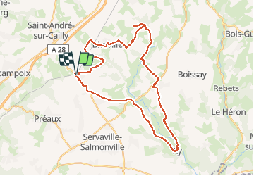
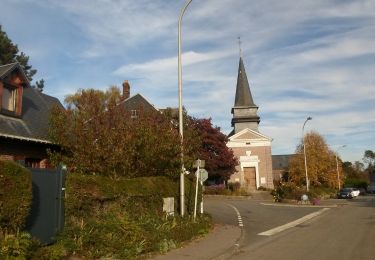
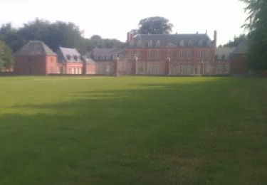
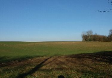
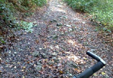
Randonnée V.T.T. de 34 km à découvrir à Normandie, Seine-Maritime, Morgny-la-Pommeraye. Cette randonnée est proposée par Grégory Letoquart.

Profil altimétrique

Photos

Localisation

Pays :
France
Région :
Normandie
Département/Province :
Seine-Maritime
Commune :
Morgny-la-Pommeraye
Localité :
Unknown
Départ:(UTM)
372954 ; 5486693 (31U) N.

Randonnées à proximité

Randonnée Marche Quincampoix - 076-29-Quincampoix 10km -496-626 - Photo
Marche
rvs147

Marche

Facile
(1)
Quincampoix, Normandie, Seine-Maritime, France
9,9 km | 11,2 km-effort
2h 28min
Oui
Randonnée Marche Préaux - 20240120-Preaux - Photo
Marche
doudet

Marche

Difficile
(1)
Préaux, Normandie, Seine-Maritime, France
12,7 km | 13,8 km-effort
3h 8min
Oui
Randonnée Marche Saint-Georges-sur-Fontaine - 20231123-St Geotges sur Fontaine - Photo
Marche
doudet

Marche

Moyen
Saint-Georges-sur-Fontaine, Normandie, Seine-Maritime, France
11 km | 12,8 km-effort
3h 4min
Oui
Randonnée Marche Saint-Georges-sur-Fontaine - 20221015-St Geirges sur Fontaine - Photo
Marche
doudet

Marche

Moyen
Saint-Georges-sur-Fontaine, Normandie, Seine-Maritime, France
11,1 km | 12,9 km-effort
3h 3min
Oui
Randonnée Marche Préaux - 20210817-Preaux - Photo
Marche
doudet

Marche

Moyen
Préaux, Normandie, Seine-Maritime, France
13 km | 16,2 km-effort
3h 42min
Oui
Randonnée Marche Bierville - bierville 3 châteaux - Photo
Marche
MichelARRP

Marche

Difficile
Bierville, Normandie, Seine-Maritime, France
17,6 km | 20 km-effort
3h 58min
Oui
Randonnée Marche Saint-Georges-sur-Fontaine - 20150207 St Georges sur fontaine - Photo
Marche
doudet

Marche

Facile
(1)
Saint-Georges-sur-Fontaine, Normandie, Seine-Maritime, France
13,1 km | 15,1 km-effort
3h 19min
Oui
Randonnée Marche Blainville-Crevon - St Pierre la Bruyère 12,7 - Photo
Marche
RC76

Marche

Moyen
(2)
Blainville-Crevon, Normandie, Seine-Maritime, France
21 km | 25 km-effort
5h 28min
Oui
Randonnée V.T.T. Quincampoix -  Forêt verte - Quincampoix - Photo
V.T.T.
tracegps

V.T.T.

Difficile
Quincampoix, Normandie, Seine-Maritime, France
44 km | 55 km-effort
3h 0min
Oui


Fermer
Mes abonnements