


LISPACH

surceneux
Utilisateur
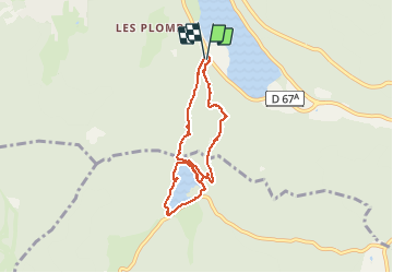

Longueur
7 km

Altitude max
1012 m

Dénivelé positif
317 m
Km-Effort
11,1 km

Altitude min
748 m

Dénivelé négatif
299 m
Boucle
Oui
Date de création :
2021-05-21 13:05:35.89
Dernière modification :
2021-05-21 16:47:27.945
2h10
Difficulté : Moyen

Application GPS de randonnée GRATUITE
 SityTrail
IGN / Instituts géographiques
SityTrail Plus
Le monde est à vous
À propos
Randonnée Marche de 7 km à découvrir à Grand Est, Vosges, Xonrupt-Longemer. Cette randonnée est proposée par surceneux.
Description
CAMPING LES JONQUILLES LONGEMER TRIANGLE ROUGE ROCHE DES VIEUX CHEVAUX FACHEPREMONT ANC. MINE CUIVRE LISPACH TOUR RETOUR COLLET DE LA MINE CROIX VERTE LONGEMER
Localisation
Pays :
France
Région :
Grand Est
Département/Province :
Vosges
Commune :
Xonrupt-Longemer
Localité :
Unknown
Départ:(Dec)
Départ:(UTM)
347101 ; 5325837 (32U) N.
Commentaires