Randonnée Trail Saint-Claude - manu cinquétral  - Photo
 rozet
rozet

Utilisateur

© OpenStreetMap contributors
Longueur
Longueur
43 km
Altitude max
Altitude max
1055 m
Dénivelé positif
Dénivelé positif
1519 m
Km-Effort
Km-Effort  
64 km
Altitude min
Altitude min
426 m
Dénivelé négatif
Dénivelé négatif
1915 m
Boucle
Boucle
Non
Date de création :
2021-06-16 05:13:59.862
Dernière modification :
2021-06-16 15:27:53.036

(0 Avis)

Trail
Trail
10h02
Difficulté : Très facile

Scannez ce code QR pour ouvrir la randonnée dans l'application SityTrail

Application GPS de randonnée GRATUITE

Logo SityTrail SityTrail

IGN / Instituts géographiques

Télécharger SityTrail sur l'App Store Télécharger SityTrail sur Google Play

Logo SityTrail SityTrail World

Le monde est à vous

Télécharger SityTrail sur l'App Store Télécharger SityTrail sur Google Play Télécharger SityTrail sur Huawei AppGallery

À propos

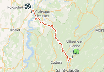
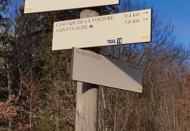
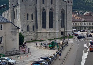
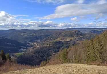
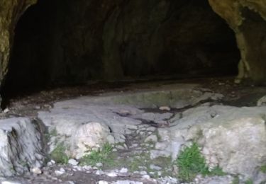
Randonnée Trail de 43 km à découvrir à Bourgogne-Franche-Comté, Jura, Saint-Claude. Cette randonnée est proposée par rozet.

Profil altimétrique

Photos

Localisation

Pays :
France
Région :
Bourgogne-Franche-Comté
Département/Province :
Jura
Commune :
Saint-Claude
Localité :
Unknown
Départ:(UTM)
721743 ; 5145754 (31T) N.

Randonnées à proximité

Randonnée Marche Saint-Claude - Belvd. Pontoux depuis Rue des Perrieres à St-Claude 39200 - Photo
Marche
Gafanhao

Marche

Moyen
Saint-Claude, Bourgogne-Franche-Comté, Jura, France
14 km | 21 km-effort
3h 30min
Oui
Randonnée Marche Saint-Claude - St Claude Cascade de la Vouivre  - Photo
Marche
Jackoyo

Marche

Facile
Saint-Claude, Bourgogne-Franche-Comté, Jura, France
7 km | 9,9 km-effort
1h 52min
Oui
Randonnée Marche Saint-Claude - De St-Claude à Vaucluse - Photo
Marche
Gafanhao

Marche

Moyen
Saint-Claude, Bourgogne-Franche-Comté, Jura, France
12,6 km | 18,7 km-effort
2h 55min
Oui
Randonnée Marche Saint-Claude - Le mont bayard a Saint claude - Photo
Marche
colomb24

Marche

Difficile
Saint-Claude, Bourgogne-Franche-Comté, Jura, France
7,3 km | 14,1 km-effort
5h 14min
Oui
Randonnée Marche Saint-Claude - les Prés de Valfin - Photo
Marche
Genisset

Marche

Moyen
(1)
Saint-Claude, Bourgogne-Franche-Comté, Jura, France
7,7 km | 11,3 km-effort
2h 6min
Oui
Randonnée Marche Leschères - promenade Vichaumois - Photo
Marche
KRISTIN59

Marche

Très facile
(1)
Leschères, Bourgogne-Franche-Comté, Jura, France
6,9 km | 9,6 km-effort
2h 30min
Oui
Randonnée Marche Leschères - barrage ravivolles - Photo
Marche
KRISTIN59

Marche

Très facile
(1)
Leschères, Bourgogne-Franche-Comté, Jura, France
5,7 km | 8,8 km-effort
2h 3min
Oui
Randonnée Marche Septmoncel les Molunes - 24-02-24 :Septmoncel, Sentier des diots du Jura - Photo
Marche
annefrance70

Marche

Moyen
Septmoncel les Molunes, Bourgogne-Franche-Comté, Jura, France
11,7 km | 16,5 km-effort
3h 35min
Oui
Randonnée Marche Saint-Claude - Mont Bayard  - Photo
Marche
Jackoyo

Marche

Très difficile
Saint-Claude, Bourgogne-Franche-Comté, Jura, France
7,5 km | 15,1 km-effort
2h 51min
Oui


Fermer
Mes abonnements