Randonnée Marche Lamoura - Le Crêt Pela - Photo
 Le jurassien
Le jurassien

Utilisateur

© OpenStreetMap contributors
Longueur
Longueur
21 km
Altitude max
Altitude max
1493 m
Dénivelé positif
Dénivelé positif
542 m
Km-Effort
Km-Effort  
28 km
Altitude min
Altitude min
1151 m
Dénivelé négatif
Dénivelé négatif
541 m
Boucle
Boucle
Oui
Date de création :
2021-07-22 07:43:56.406
Dernière modification :
2021-07-22 16:41:48.416

(0 Avis)

Marche
Marche
5h37
Difficulté : Moyen

Scannez ce code QR pour ouvrir la randonnée dans l'application SityTrail

Application GPS de randonnée GRATUITE

Logo SityTrail SityTrail

IGN / Instituts géographiques

Télécharger SityTrail sur l'App Store Télécharger SityTrail sur Google Play

Logo SityTrail SityTrail World

Le monde est à vous

Télécharger SityTrail sur l'App Store Télécharger SityTrail sur Google Play Télécharger SityTrail sur Huawei AppGallery

À propos

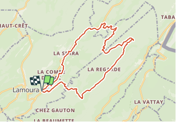
Randonnée Marche de 21 km à découvrir à Bourgogne-Franche-Comté, Jura, Lamoura. Cette randonnée est proposée par Le jurassien.

Description

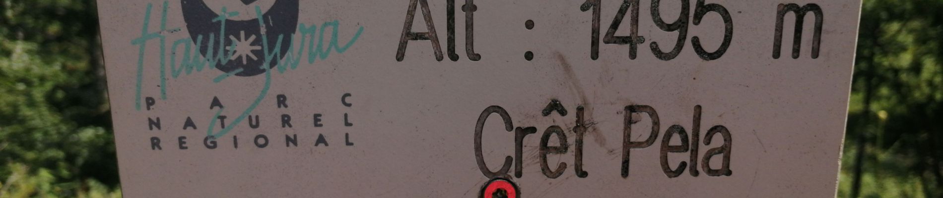
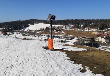
Départ du lac de Lamoura pour la Balise d'amont, la pièce d'aval, la Regarde, le chalet de la  Combe, l'épicéa muté, le Crêt Pela 1495m,le chalet de la Frasse et retour au lac de Lamoura.

Profil altimétrique

Photos

Localisation

Pays :
France
Région :
Bourgogne-Franche-Comté
Département/Province :
Jura
Commune :
Lamoura
Localité :
Unknown
Départ:(UTM)
729002 ; 5142184 (31T) N.

Randonnées à proximité

Randonnée Marche Lamoura - Tresberruy - Lamoura - Photo
Marche
tracegps

Marche

Difficile
(1)
Lamoura, Bourgogne-Franche-Comté, Jura, France
14,5 km | 20 km-effort
4h 0min
Oui
Randonnée Vélo Lajoux - Lajoux / Bellecombe - Photo
Vélo
daniellebou

Vélo

Très facile
(1)
Lajoux, Bourgogne-Franche-Comté, Jura, France
21 km | 26 km-effort
Inconnu
Oui
Randonnée Course à pied Mijoux - UTTJ 2015-2 - Photo
Course à pied
bourel.jacques

Course à pied

Très difficile
(1)
Mijoux, Auvergne-Rhône-Alpes, Ain, France
57 km | 92 km-effort
18h 13min
Non
Randonnée Marche Gex - Balade à Col de la Faucille, Gex - Photo
Marche
Gaiato

Marche

Très difficile
Gex, Auvergne-Rhône-Alpes, Ain, France
86 km | 135 km-effort
9h 23min
Non
Randonnée Cyclotourisme Mijoux - LES ROUSSES - COL DE LA FAUCILLE  - Photo
Cyclotourisme
jean-marie.parachini

Cyclotourisme

Très difficile
Mijoux, Auvergne-Rhône-Alpes, Ain, France
54 km | 68 km-effort
4h 57min
Non
Randonnée Marche Lamoura - Autour Lamoura - Photo
Marche
swp648

Marche

Moyen
Lamoura, Bourgogne-Franche-Comté, Jura, France
17,1 km | 25 km-effort
4h 37min
Oui
Randonnée Raquettes à neige Lamoura - Lamoura 14km D+ 493 20210228 - Photo
Raquettes à neige
cmike39

Raquettes à neige

Très facile
Lamoura, Bourgogne-Franche-Comté, Jura, France
14 km | 21 km-effort
3h 36min
Oui
Randonnée Marche Gex - la faucille - montrond - Photo
Marche
thierrytm

Marche

Moyen
Gex, Auvergne-Rhône-Alpes, Ain, France
12,4 km | 22 km-effort
1h 35min
Non
Randonnée Marche Septmoncel les Molunes - Tour lapidaires - Photo
Marche
thierrytm

Marche

Moyen
(1)
Septmoncel les Molunes, Bourgogne-Franche-Comté, Jura, France
8,7 km | 13,4 km-effort
2h 26min
Oui


Fermer
Mes abonnements