Randonnée Marche Bussy-en-Othe - 210725 Bussy en Othe - Photo
 Specialized77
Specialized77

Utilisateur

© OpenStreetMap contributors
Longueur
Longueur
11,4 km
Altitude max
Altitude max
259 m
Dénivelé positif
Dénivelé positif
193 m
Km-Effort
Km-Effort  
13,9 km
Altitude min
Altitude min
152 m
Dénivelé négatif
Dénivelé négatif
193 m
Boucle
Boucle
Oui
Date de création :
2021-07-25 07:00:12.87
Dernière modification :
2022-04-11 14:46:29.26

(0 Avis)

Marche
Marche
3h58
Difficulté : Facile

Scannez ce code QR pour ouvrir la randonnée dans l'application SityTrail

Application GPS de randonnée GRATUITE

Logo SityTrail SityTrail

IGN / Instituts géographiques

Télécharger SityTrail sur l'App Store Télécharger SityTrail sur Google Play

Logo SityTrail SityTrail World

Le monde est à vous

Télécharger SityTrail sur l'App Store Télécharger SityTrail sur Google Play Télécharger SityTrail sur Huawei AppGallery

À propos

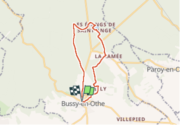
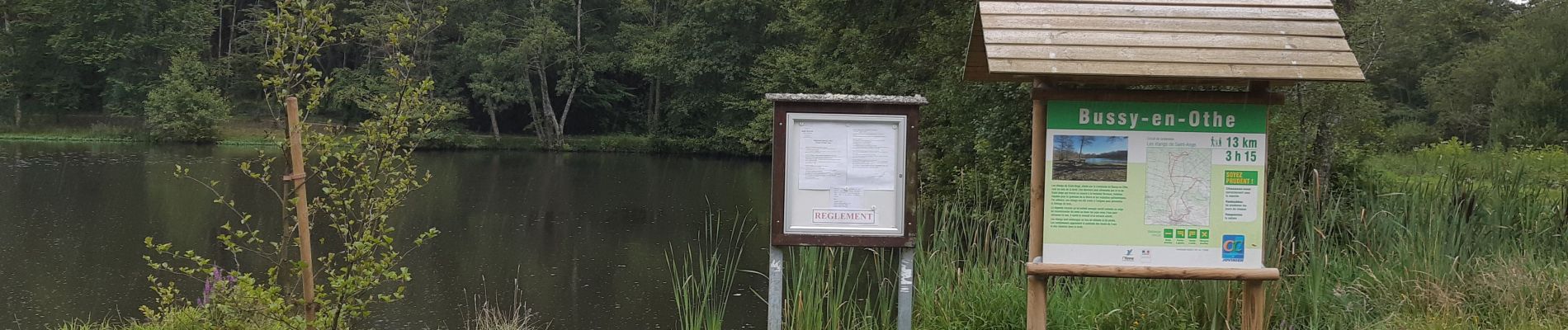
Randonnée Marche de 11,4 km à découvrir à Bourgogne-Franche-Comté, Yonne, Bussy-en-Othe. Cette randonnée est proposée par Specialized77.

Description

Avec Paron rebondir

Profil altimétrique

Photos

Localisation

Pays :
France
Région :
Bourgogne-Franche-Comté
Département/Province :
Yonne
Commune :
Bussy-en-Othe
Localité :
Unknown
Départ:(UTM)
538270 ; 5318589 (31U) N.

Randonnées à proximité

Randonnée Marche Bussy-en-Othe - Bussy Les étangs de St Ange - Photo
Marche
papyjv8991

Marche

Facile
Bussy-en-Othe, Bourgogne-Franche-Comté, Yonne, France
7,2 km | 8,3 km-effort
1h 49min
Oui
Randonnée Marche Bussy-en-Othe - st ange - Photo
Marche
c.chehere

Marche

Très facile
Bussy-en-Othe, Bourgogne-Franche-Comté, Yonne, France
3,4 km | 3,9 km-effort
1h 13min
Non
Randonnée Marche Bussy-en-Othe - 3 mai - Photo
Marche
c.chehere

Marche

Très facile
Bussy-en-Othe, Bourgogne-Franche-Comté, Yonne, France
2,3 km | 2,6 km-effort
1h 13min
Oui


Fermer
Mes abonnements