Randonnée Marche Saint-Étienne-de-Baïgorry - GR 10 5ème étape : St Étienne de Baïgorry - St Jean Pied De Port  - Photo

GR 10 5ème étape : St Étienne de Baïgorry - St Jean Pied De Port

 LEGUE
LEGUE

Utilisateur

© OpenStreetMap contributors
Longueur
Longueur
22 km
Altitude max
Altitude max
1015 m
Dénivelé positif
Dénivelé positif
1069 m
Km-Effort
Km-Effort  
36 km
Altitude min
Altitude min
159 m
Dénivelé négatif
Dénivelé négatif
1087 m
Boucle
Boucle
Non
Date de création :
2021-08-06 07:06:40.0
Dernière modification :
2021-08-06 14:45:02.954

(0 Avis)

Marche
Marche
4h31
Difficulté : Moyen

Scannez ce code QR pour ouvrir la randonnée dans l'application SityTrail

Application GPS de randonnée GRATUITE

Logo SityTrail SityTrail

IGN / Instituts géographiques

Télécharger SityTrail sur l'App Store Télécharger SityTrail sur Google Play

Logo SityTrail SityTrail World

Le monde est à vous

Télécharger SityTrail sur l'App Store Télécharger SityTrail sur Google Play Télécharger SityTrail sur Huawei AppGallery

À propos

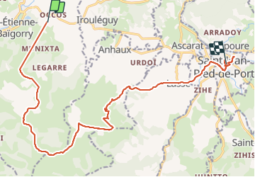
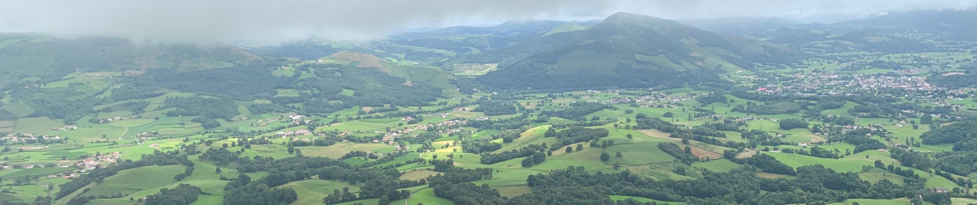
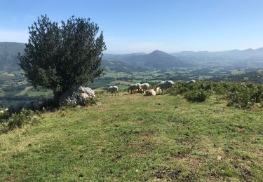
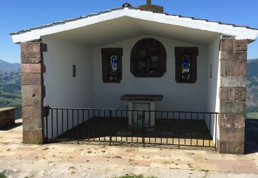
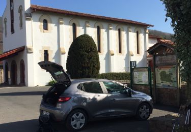
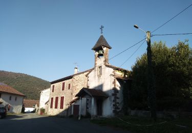
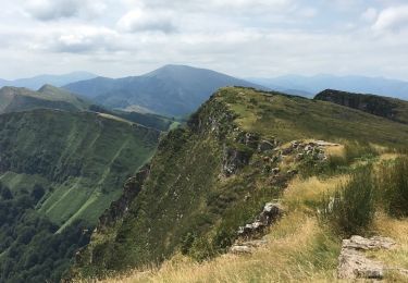
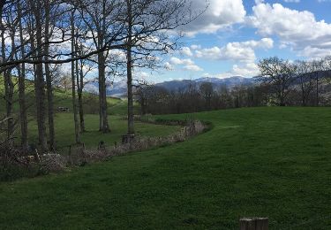
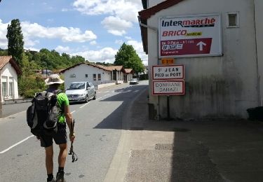
Randonnée Marche de 22 km à découvrir à Nouvelle-Aquitaine, Pyrénées-Atlantiques, Saint-Étienne-de-Baïgorry. Cette randonnée est proposée par LEGUE.

Profil altimétrique

Photos

Localisation

Pays :
France
Région :
Nouvelle-Aquitaine
Département/Province :
Pyrénées-Atlantiques
Commune :
Saint-Étienne-de-Baïgorry
Localité :
Unknown
Départ:(Dec)
Départ:(UTM)
636242 ; 4782038 (30T) N.

Randonnées à proximité

Randonnée Marche Saint-Étienne-de-Baïgorry - iparla - Photo
Marche
jcaudron

Marche

Très facile
(1)
Saint-Étienne-de-Baïgorry, Nouvelle-Aquitaine, Pyrénées-Atlantiques, France
13,5 km | 25 km-effort
4h 45min
Oui
Randonnée Marche Saint-Étienne-de-Baïgorry - Chapelle ailandoi depuis st Etienne Baïgorry  - Photo
Marche
dlenaour56

Marche

(2)
Saint-Étienne-de-Baïgorry, Nouvelle-Aquitaine, Pyrénées-Atlantiques, France
13,2 km | 24 km-effort
3h 53min
Oui
Randonnée Marche Saint-Étienne-de-Baïgorry - Boucle oylarandoy - Photo
Marche
jaja64

Marche

Moyen
Saint-Étienne-de-Baïgorry, Nouvelle-Aquitaine, Pyrénées-Atlantiques, France
14,3 km | 25 km-effort
4h 55min
Oui
Randonnée Marche Irouléguy - Jara Irouléguy boucle - Photo
Marche
jaja64

Marche

Moyen
Irouléguy, Nouvelle-Aquitaine, Pyrénées-Atlantiques, France
10,4 km | 18,4 km-effort
3h 27min
Oui
Randonnée Marche Saint-Étienne-de-Baïgorry - Urdos pic d'Iparla - Photo
Marche
helmut68

Marche

Moyen
Saint-Étienne-de-Baïgorry, Nouvelle-Aquitaine, Pyrénées-Atlantiques, France
15,3 km | 28 km-effort
5h 40min
Non
Randonnée Marche Saint-Étienne-de-Baïgorry - crêtes d'Iparla depuis Urdos - Photo
Marche
so.duchateau

Marche

Difficile
(1)
Saint-Étienne-de-Baïgorry, Nouvelle-Aquitaine, Pyrénées-Atlantiques, France
11,7 km | 22 km-effort
5h 17min
Oui
Randonnée Marche Anhaux - Guide Munhoa boucle - Photo
Marche
christian33

Marche

Très facile
Anhaux, Nouvelle-Aquitaine, Pyrénées-Atlantiques, France
13,3 km | 25 km-effort
6h 20min
Oui
Randonnée Autre activité Saint-Étienne-de-Baïgorry - TDP N°5 ST ÉTIENNE DE BAIGORRY ST JEAN PIEDS DE PORT - Photo
Autre activité
jeff2

Autre activité

Très facile
Saint-Étienne-de-Baïgorry, Nouvelle-Aquitaine, Pyrénées-Atlantiques, France
19,6 km | 33 km-effort
7h 7min
Non
Randonnée Marche Anhaux - Munhoa boucle - Photo
Marche
jaja64

Marche

Très facile
Anhaux, Nouvelle-Aquitaine, Pyrénées-Atlantiques, France
13,3 km | 25 km-effort
6h 20min
Oui


Fermer
Mes abonnements