


Grand ballon descente jungholtz

Derrendinger
Utilisateur

Longueur
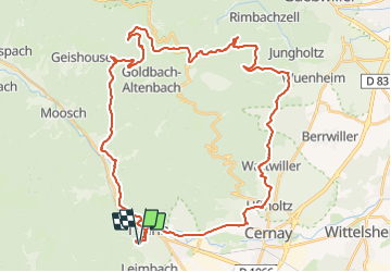
46 km

Altitude max
1156 m

Dénivelé positif
1284 m
Km-Effort
63 km

Altitude min
306 m

Dénivelé négatif
1284 m
Boucle
Oui
Date de création :
2021-08-26 09:01:32.628
Dernière modification :
2021-08-26 09:18:13.318
4h21
Difficulté : Très difficile

Application GPS de randonnée GRATUITE
 SityTrail
IGN / Instituts géographiques
SityTrail Plus
Le monde est à vous
À propos
Randonnée V.T.T. de 46 km à découvrir à Grand Est, Haut-Rhin, Thann. Cette randonnée est proposée par Derrendinger.
Localisation
Pays :
France
Région :
Grand Est
Département/Province :
Haut-Rhin
Commune :
Thann
Localité :
Unknown
Départ:(Dec)
Départ:(UTM)
357540 ; 5296257 (32T) N.
Commentaires