Randonnée Marche Saint-Agnan-en-Vercors - trop Alexis - Photo
 jphugon
jphugon

Utilisateur

© OpenStreetMap contributors
Longueur
Longueur
16,3 km
Altitude max
Altitude max
1269 m
Dénivelé positif
Dénivelé positif
859 m
Km-Effort
Km-Effort  
28 km
Altitude min
Altitude min
829 m
Dénivelé négatif
Dénivelé négatif
856 m
Boucle
Boucle
Oui
Date de création :
2021-08-26 07:09:52.574
Dernière modification :
2021-08-26 16:39:56.657

(0 Avis)

Marche
Marche
7h59
Difficulté : Très difficile

Scannez ce code QR pour ouvrir la randonnée dans l'application SityTrail

Application GPS de randonnée GRATUITE

Logo SityTrail SityTrail

IGN / Instituts géographiques

Télécharger SityTrail sur l'App Store Télécharger SityTrail sur Google Play

Logo SityTrail SityTrail World

Le monde est à vous

Télécharger SityTrail sur l'App Store Télécharger SityTrail sur Google Play Télécharger SityTrail sur Huawei AppGallery

À propos

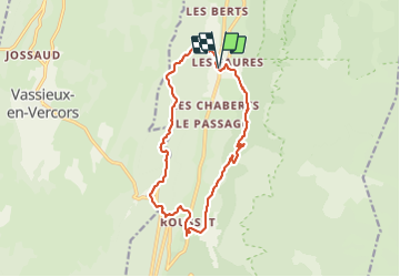
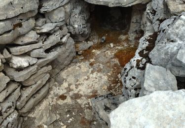
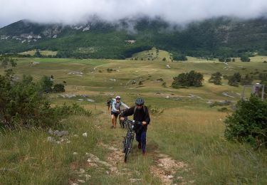
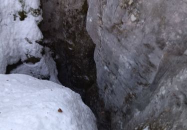
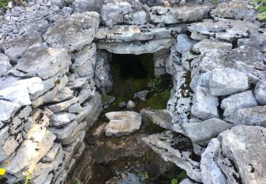
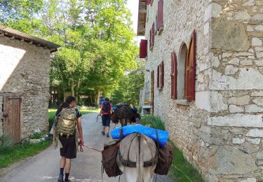
Randonnée Marche de 16,3 km à découvrir à Auvergne-Rhône-Alpes, Drôme, Saint-Agnan-en-Vercors. Cette randonnée est proposée par jphugon.

Description

départ hameaux des Faures

Profil altimétrique

Photos

Localisation

Pays :
France
Région :
Auvergne-Rhône-Alpes
Département/Province :
Drôme
Commune :
Saint-Agnan-en-Vercors
Localité :
Unknown
Départ:(UTM)
691506 ; 4975044 (31T) N.

Randonnées à proximité

Randonnée Marche Saint-Agnan-en-Vercors - Vercors - La Coche Grand Veymont Queyrie - Photo
Marche
Alfredy

Marche

Très facile
(1)
Saint-Agnan-en-Vercors, Auvergne-Rhône-Alpes, Drôme, France
24 km | 33 km-effort
7h 22min
Oui
Randonnée Marche Vassieux-en-Vercors - Vassieux-en-Vercors - Le Puy de la Gagère - Photo
Marche
Philindy26

Marche

Facile
Vassieux-en-Vercors, Auvergne-Rhône-Alpes, Drôme, France
13,1 km | 21 km-effort
3h 45min
Oui
Randonnée Marche Saint-Agnan-en-Vercors - Les Hauts Plateaux du Vercors - Photo
Marche
Greg813

Marche

Difficile
Saint-Agnan-en-Vercors, Auvergne-Rhône-Alpes, Drôme, France
12 km | 19,1 km-effort
3h 51min
Oui
Randonnée Marche Saint-Agnan-en-Vercors - 26 tiolache - Photo
Marche
himba26100

Marche

Facile
Saint-Agnan-en-Vercors, Auvergne-Rhône-Alpes, Drôme, France
14,4 km | 21 km-effort
6h 13min
Oui
Randonnée V.T.T. Vassieux-en-Vercors - vassieux La Frache - Photo
V.T.T.
crocau

V.T.T.

Facile
Vassieux-en-Vercors, Auvergne-Rhône-Alpes, Drôme, France
10,9 km | 13,3 km-effort
1h 45min
Oui
Randonnée Raquettes à neige La Chapelle-en-Vercors - 26 raq claveyron - Photo
Raquettes à neige
himba26100

Raquettes à neige

Moyen
La Chapelle-en-Vercors, Auvergne-Rhône-Alpes, Drôme, France
15,2 km | 23 km-effort
7h 51min
Oui
Randonnée Marche Saint-Agnan-en-Vercors - 26 st Agnan champ gros de la vache - Photo
Marche
himba26100

Marche

Moyen
Saint-Agnan-en-Vercors, Auvergne-Rhône-Alpes, Drôme, France
16,9 km | 27 km-effort
6h 51min
Oui
Randonnée Marche Saint-Agnan-en-Vercors - Malaval  - Photo
Marche
ajd26

Marche

Très difficile
Saint-Agnan-en-Vercors, Auvergne-Rhône-Alpes, Drôme, France
14,6 km | 24 km-effort
5h 49min
Oui
Randonnée Marche Vassieux-en-Vercors - Vassieux en Vercors- La Chapelle en Vercors- Rando Âne (2 et 3 ème jour) -  - Photo
Marche
crocau

Marche

Facile
Vassieux-en-Vercors, Auvergne-Rhône-Alpes, Drôme, France
15,4 km | 19,3 km-effort
5h 11min
Non


Fermer
Mes abonnements