Randonnée Marche Saint-Cirq-Lapopie - Du camping de la Truffière à Bouziès - Photo

Du camping de la Truffière à Bouziès

 ilur56
ilur56

Utilisateur

© OpenStreetMap contributors
Longueur
Longueur
15,3 km
Altitude max
Altitude max
371 m
Dénivelé positif
Dénivelé positif
539 m
Km-Effort
Km-Effort  
23 km
Altitude min
Altitude min
129 m
Dénivelé négatif
Dénivelé négatif
539 m
Boucle
Boucle
Oui
Date de création :
2021-08-30 07:55:26.319
Dernière modification :
2021-09-04 15:09:03.945

(0 Avis)

Marche
Marche
5h22
Difficulté : Moyen

Scannez ce code QR pour ouvrir la randonnée dans l'application SityTrail

Application GPS de randonnée GRATUITE

Logo SityTrail SityTrail

IGN / Instituts géographiques

Télécharger SityTrail sur l'App Store Télécharger SityTrail sur Google Play

Logo SityTrail SityTrail World

Le monde est à vous

Télécharger SityTrail sur l'App Store Télécharger SityTrail sur Google Play Télécharger SityTrail sur Huawei AppGallery

À propos

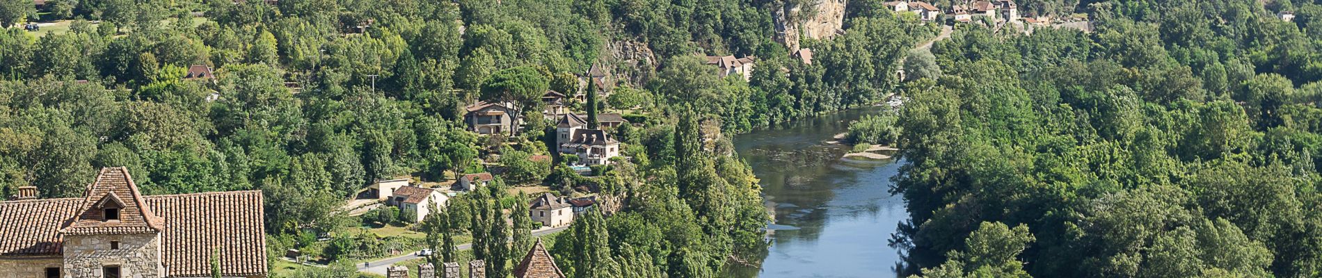
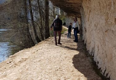
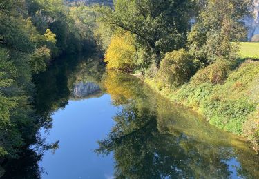
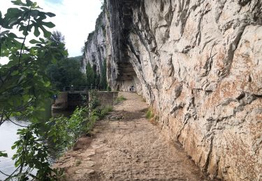
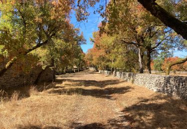
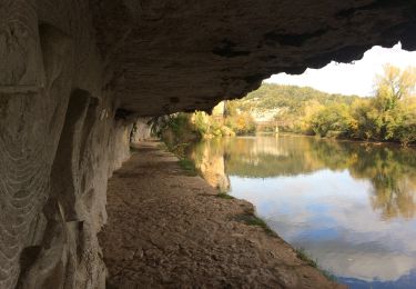
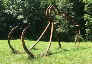
Randonnée Marche de 15,3 km à découvrir à Occitanie, Lot, Saint-Cirq-Lapopie. Cette randonnée est proposée par ilur56.

Description

Boucle au dessus et le long du Lot entre Saint Cirq Lapopie et Bouziès au départ du camping de La Truffière

Profil altimétrique

Photos

Localisation

Pays :
France
Région :
Occitanie
Département/Province :
Lot
Commune :
Saint-Cirq-Lapopie
Localité :
Unknown
Départ:(UTM)
394660 ; 4922520 (31T) N.

Randonnées à proximité

Randonnée Marche Saint-Cirq-Lapopie - Circuit sud de St Cirq Lapopie - Photo
Marche
tracegps

Marche

Difficile
(4)
Saint-Cirq-Lapopie, Occitanie, Lot, France
17,7 km | 24 km-effort
3h 30min
Oui
Randonnée Marche Bouziès - St Cirq Lapopie - Photo
Marche
neleda

Marche

Très facile
(1)
Bouziès, Occitanie, Lot, France
8,3 km | 12,4 km-effort
2h 33min
Non
Randonnée sport Saint-Cirq-Lapopie - 20240422 St Cirq - Vers - Photo
sport
ThonyM

sport

Très facile
Saint-Cirq-Lapopie, Occitanie, Lot, France
22 km | 31 km-effort
Inconnu
Non
Randonnée Marche Lugagnac - Lugagnac f - Photo
Marche
GUIDE
antignacs

Marche

Facile
Lugagnac, Occitanie, Lot, France
13,8 km | 18 km-effort
3h 1min
Oui
Randonnée Marche Bouziès - Bouzies St Cirq Conduche  - Photo
Marche
GUIDE
antignacs

Marche

Très facile
Bouziès, Occitanie, Lot, France
15,3 km | 21 km-effort
4h 11min
Oui
Randonnée Marche Saint-Cirq-Lapopie - Saint Cirq à Cabrerets - Photo
Marche
dominiq

Marche

Moyen
Saint-Cirq-Lapopie, Occitanie, Lot, France
11,7 km | 17,7 km-effort
3h 40min
Non
Randonnée Marche Crégols - Concots font d’erbies  - Photo
Marche
GUIDE
antignacs

Marche

Très facile
Crégols, Occitanie, Lot, France
13,4 km | 16,9 km-effort
3h 2min
Oui
Randonnée V.T.C. Bouziès - Bouzies sauliac cenevieres  - Photo
V.T.C.
GUIDE
antignacs

V.T.C.

Très facile
Bouziès, Occitanie, Lot, France
38 km | 51 km-effort
2h 47min
Non
Randonnée Marche Bouziès - Bouzies saint cirq  - Photo
Marche
GUIDE
antignacs

Marche

Très facile
Bouziès, Occitanie, Lot, France
15,3 km | 22 km-effort
3h 50min
Oui


Fermer
Mes abonnements