Randonnée Marche Saint-Jeannet - St- Jeannet - Photo
 lviallet
lviallet

Utilisateur

© OpenStreetMap contributors
Longueur
Longueur
13,8 km
Altitude max
Altitude max
891 m
Dénivelé positif
Dénivelé positif
466 m
Km-Effort
Km-Effort  
20 km
Altitude min
Altitude min
582 m
Dénivelé négatif
Dénivelé négatif
467 m
Boucle
Boucle
Oui
Date de création :
2021-09-12 07:44:16.0
Dernière modification :
2021-09-13 09:42:18.199

(0 Avis)

Marche
Marche
3h49
Difficulté : Très difficile

Scannez ce code QR pour ouvrir la randonnée dans l'application SityTrail

Application GPS de randonnée GRATUITE

Logo SityTrail SityTrail

IGN / Instituts géographiques

Télécharger SityTrail sur l'App Store Télécharger SityTrail sur Google Play

Logo SityTrail SityTrail World

Le monde est à vous

Télécharger SityTrail sur l'App Store Télécharger SityTrail sur Google Play Télécharger SityTrail sur Huawei AppGallery

À propos

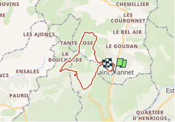
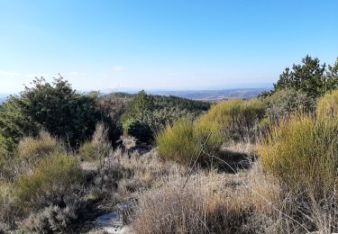
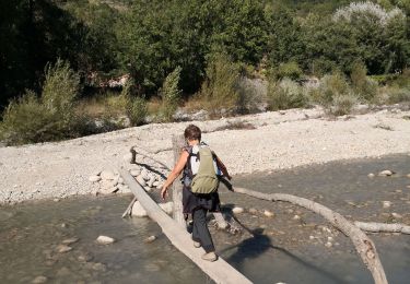
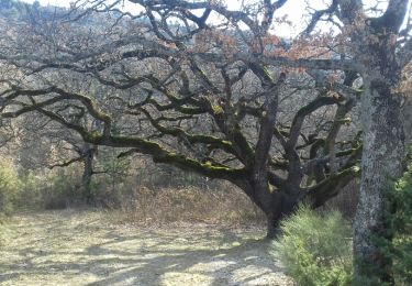
Randonnée Marche de 13,8 km à découvrir à Provence-Alpes-Côte d'Azur, Alpes-de-Haute-Provence, Saint-Jeannet. Cette randonnée est proposée par lviallet.

Profil altimétrique

Localisation

Pays :
France
Région :
Provence-Alpes-Côte d'Azur
Département/Province :
Alpes-de-Haute-Provence
Commune :
Saint-Jeannet
Localité :
Unknown
Départ:(Dec)
Départ:(UTM)
269256 ; 4870456 (32T) N.

Randonnées à proximité

Randonnée Marche Saint-Julien-d'Asse - 2024-02-06 Saint Julien d Asse - Photo
Marche
GUIDE
Kargil

Marche

Facile
(1)
Saint-Julien-d'Asse, Provence-Alpes-Côte d'Azur, Alpes-de-Haute-Provence, France
14,4 km | 20 km-effort
4h 33min
Oui
Randonnée Marche Estoublon - estoublon sentier des oliviers gorges trevans 21k 950m  - Photo
Marche
Danielba

Marche

Facile
Estoublon, Provence-Alpes-Côte d'Azur, Alpes-de-Haute-Provence, France
21 km | 33 km-effort
8h 8min
Oui
Randonnée Marche Entrevennes - ensales  . ajonc - Photo
Marche
Jemasa9

Marche

Facile
Entrevennes, Provence-Alpes-Côte d'Azur, Alpes-de-Haute-Provence, France
7,2 km | 9,7 km-effort
2h 13min
Oui
Randonnée Marche Saint-Jeannet - Le Somme  du plateau  d entrevenne  - Photo
Marche
Jemasa9

Marche

Moyen
Saint-Jeannet, Provence-Alpes-Côte d'Azur, Alpes-de-Haute-Provence, France
10,4 km | 14,7 km-effort
4h 21min
Oui
Randonnée Marche Estoublon - Estoublon au château de Trévans  - Photo
Marche
PITOUSSAINT

Marche

Très facile
Estoublon, Provence-Alpes-Côte d'Azur, Alpes-de-Haute-Provence, France
10,9 km | 16,3 km-effort
5h 31min
Oui
Randonnée V.T.T. Estoublon - [PAT] Rando Estoublon - Photo
V.T.T.
spiroudigne

V.T.T.

Moyen
Estoublon, Provence-Alpes-Côte d'Azur, Alpes-de-Haute-Provence, France
15,8 km | 22 km-effort
1h 47min
Oui
Randonnée Marche Bras-d'Asse - BRAS D ASSE . Le tour de Saint Jeannet cimetiere  o l s  - Photo
Marche
RobinMicheline

Marche

Moyen
Bras-d'Asse, Provence-Alpes-Côte d'Azur, Alpes-de-Haute-Provence, France
22 km | 30 km-effort
6h 21min
Non
Randonnée Marche Saint-Jurs - 04_La Blache_Le Chaffaut_J7_rea_corrigé - Photo
Marche
jab31

Marche

Difficile
Saint-Jurs, Provence-Alpes-Côte d'Azur, Alpes-de-Haute-Provence, France
25 km | 34 km-effort
6h 36min
Non
Randonnée Marche Estoublon - estoublon - Photo
Marche
cocojean

Marche

Moyen
Estoublon, Provence-Alpes-Côte d'Azur, Alpes-de-Haute-Provence, France
8,6 km | 11,3 km-effort
2h 34min
Non


Fermer
Mes abonnements