Randonnée V.T.C. Saint-Laurent-sur-Oust - jeudi 16 septembre  2021 - Photo
 herve.feurprier
herve.feurprier

Utilisateur

© OpenStreetMap contributors
Longueur
Longueur
74 km
Altitude max
Altitude max
119 m
Dénivelé positif
Dénivelé positif
688 m
Km-Effort
Km-Effort  
83 km
Altitude min
Altitude min
0 m
Dénivelé négatif
Dénivelé négatif
694 m
Boucle
Boucle
Non
Date de création :
2021-09-16 06:51:43.669
Dernière modification :
2021-09-16 15:00:19.157

(0 Avis)

V.T.C.
V.T.C.
5h08
Difficulté : Moyen

Scannez ce code QR pour ouvrir la randonnée dans l'application SityTrail

Application GPS de randonnée GRATUITE

Logo SityTrail SityTrail

IGN / Instituts géographiques

Télécharger SityTrail sur l'App Store Télécharger SityTrail sur Google Play

Logo SityTrail SityTrail World

Le monde est à vous

Télécharger SityTrail sur l'App Store Télécharger SityTrail sur Google Play Télécharger SityTrail sur Huawei AppGallery

À propos

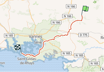
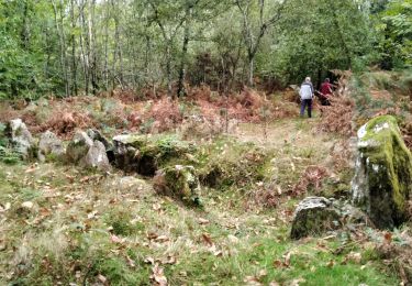
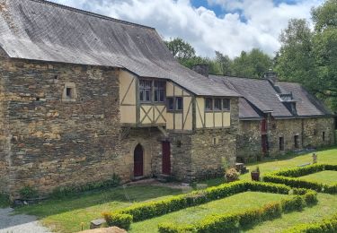
Randonnée V.T.C. de 74 km à découvrir à Bretagne, Morbihan, Saint-Laurent-sur-Oust. Cette randonnée est proposée par herve.feurprier.

Profil altimétrique

Localisation

Pays :
France
Région :
Bretagne
Département/Province :
Morbihan
Commune :
Saint-Laurent-sur-Oust
Localité :
Unknown
Départ:(UTM)
550976 ; 5293768 (30T) N.

Randonnées à proximité

Randonnée Marche Saint-Laurent-sur-Oust - GR_347_AC_03_St-Laurent-Oust_Serent_20190331 - Photo
Marche
patrickdanilo

Marche

Facile
Saint-Laurent-sur-Oust, Bretagne, Morbihan, France
19,1 km | 23 km-effort
4h 20min
Non
Randonnée Marche nordique Malestroit - grand tour de l' Oust au canal Malestroit  - Photo
Marche nordique
Bernard 56

Marche nordique

Moyen
Malestroit, Bretagne, Morbihan, France
10,9 km | 11,8 km-effort
2h 48min
Non
Randonnée Cyclotourisme Malestroit - Eurovélo : de Malestroit à Josselin - Photo
Cyclotourisme
ilur56

Cyclotourisme

Très difficile
Malestroit, Bretagne, Morbihan, France
51 km | 57 km-effort
Inconnu
Oui
Randonnée Marche Saint-Laurent-sur-Oust - Saint Laurent sur oust - Photo
Marche
motardfou.dgs

Marche

Facile
(1)
Saint-Laurent-sur-Oust, Bretagne, Morbihan, France
8,9 km | 11 km-effort
2h 0min
Oui
Randonnée Marche Malestroit - Malestroit CA 4 05 2023 - Photo
Marche
med88

Marche

Moyen
Malestroit, Bretagne, Morbihan, France
19 km | 22 km-effort
4h 20min
Oui
Randonnée Marche Pleucadeuc - Circuit de Saint Marc - Pleucadeuc - Photo
Marche
chasle

Marche

Moyen
Pleucadeuc, Bretagne, Morbihan, France
22 km | 26 km-effort
5h 30min
Oui
Randonnée Marche Malestroit - Boucle de L'Oust au canal de Nantes à Brest à partir de Malestroit - Photo
Marche
EricVIBERT

Marche

Facile
Malestroit, Bretagne, Morbihan, France
16,7 km | 18,1 km-effort
4h 1min
Oui
Randonnée Marche Malestroit - Canal Nantes à Brest Jour 6 - Photo
Marche
copter

Marche

Moyen
Malestroit, Bretagne, Morbihan, France
26 km | 29 km-effort
6h 18min
Non
Randonnée Marche Pleucadeuc - pleucadeuc - Photo
Marche
gooogor

Marche

Très facile
Pleucadeuc, Bretagne, Morbihan, France
12,7 km | 15 km-effort
2h 45min
Oui


Fermer
Mes abonnements