


30 Sept 2021 circuit boucle 2 PNR

gilbertdu60
Utilisateur

Longueur
22 km

Altitude max
150 m

Dénivelé positif
302 m
Km-Effort
26 km

Altitude min
86 m

Dénivelé négatif
304 m
Boucle
Oui
Date de création :
2021-09-30 11:10:38.555
Dernière modification :
2022-05-09 16:37:55.208
2h00
Difficulté : Facile

Application GPS de randonnée GRATUITE
 SityTrail
IGN / Instituts géographiques
SityTrail Plus
Le monde est à vous
À propos
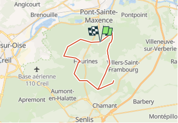
Randonnée V.T.C. de 22 km à découvrir à Hauts-de-France, Oise, Villers-Saint-Frambourg-Ognon. Cette randonnée est proposée par gilbertdu60.
Description
Randonnée V.T.C. de 22 km . Cette randonnée est proposée par O.T CCPOH et AU5V.
Localisation
Pays :
France
Région :
Hauts-de-France
Département/Province :
Oise
Commune :
Villers-Saint-Frambourg-Ognon
Localité :
Unknown
Départ:(Dec)
Départ:(UTM)
471426 ; 5458370 (31U) N.
Commentaires