


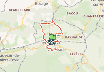

17,2 km | 24 km-effort


Utilisateur


Application GPS de randonnée GRATUITE
 SityTrail
IGN / Instituts géographiques
SityTrail World
Le monde est à vous
Randonnée Marche de 11,8 km à découvrir à Occitanie, Ariège, Camarade. Cette randonnée est proposée par pidjam.
Attention cette randonnée n'est plus faisable (barrage au hameau Berdot où les chemins ont été volontairement bloqués et les signalisations enlevées à la gouge dans les arbres); le chemin de petite randonnée ne peut plus passer de ce côté là.

V.T.T.
Marche
A pied

Cheval

Cheval

A pied

Marche
Marche
Marche